
4. Citytrip to Hanseatic Bremen – The Schlachte and the Weser
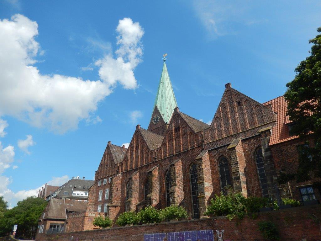
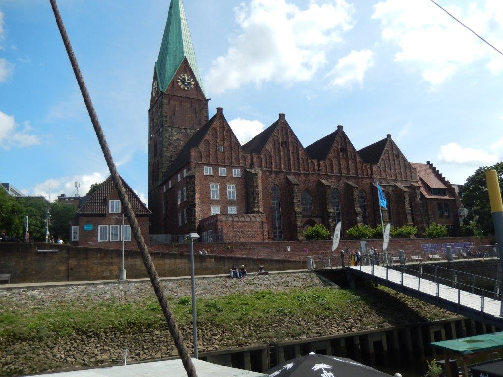
After exiting the Böttcherstraße, The Wandelgek had arrived on Bremen’s river Weser quay. At the beginning of the Böttcherstraße (The Wandelgek had walked the Böttcherstraße from the end at the Marktplatz to the beginning), was the Bremer Schlachte.
The Schlachte
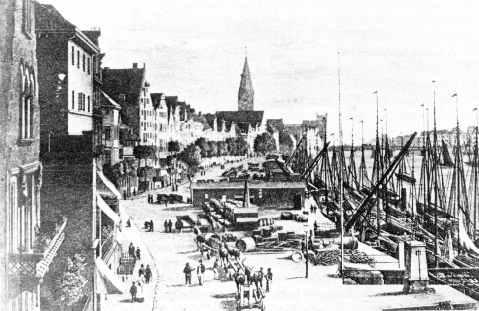
The Schlachte is the name given to the historic waterfront promenade along the Weser River in Bremen’s Old Town. Officially, the Schlachte is a street running parallel to the riverbank, beginning at the corner of Erste Schlachtpforte (near St. Martini Church) and ending about 660 meters further northwest at the Bremen Youth Hostel (Haus der Jugend) at the corner of Kalkstraße. Originally Bremen’s harbor square, Schlachte has now been transformed into a mile of restaurants and beer gardens.
The name Schlachte comes from “slagte,” meaning “the driving in of the embankment posts, which were held in place with beams and fascine wickerwork and secured the riverbank. The term originates from Low German and is used in other forms—such as the more original “Schlagde”—for similar embankments throughout northern Germany. This area was first documented in 1250 as “slait,” later also referred to as “slagte” and “slacht.”
In 1247, the previously undeveloped strip of shore in front of the city wall between St. Martin’s Church and the present-day Second Schlachte Gate was settled by Bremen citizens, presumably long-distance traders. In a privilege issued in 1250, the water millers were obliged to maintain this area, first referred to here as a “slait,” meaning fortified with driven-in piles. From these and other facts, it is assumed that a port operation emerged at this location in the mid-13th century, even though the Balge, which had long been used for this purpose, was also available for shipping traffic (albeit with a shallower draft) for a long time to come. At the same time, this phase of development marked the beginning of the separation of market and harbor square, as there were only a few stalls on the Schlachte itself. Ships with a carrying capacity of up to about 100 tons, such as the Bremen Hanseatic cog, were likely to have called at Schlachtehafen until the late Middle Ages. “The Schlachte therefore certainly also served as a seaport.”
The view of the Schlachte in the woodcut from 1550/54 clearly shows a wooden quay fortification. Shortly afterwards, it was replaced by a stone embankment wall, the city walls along the shore were gradually dismantled, and in 1557, the Schlachte was legally incorporated into the city limits. Ten alleys later led from the city to the harbor square, counting downstream: the First Battle Gate, the Josephsgang, the Ulenstein, the Second Battle Gate, the Heimlichen Gate, the Ansgaritränk Gate, the Kran Gate, the Düstern Gate, the Zingel Gate, and the Last Battle Gate. They were manned by guards and locked at night.
Between 1600 and 1830, little changed in the appearance, organization, and technical equipment of Bremen’s Schlachte harbor.
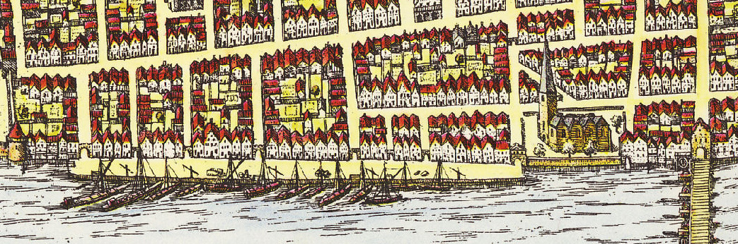
Its length reached 450 meters and stretched from St. Martin’s Church almost to the Kornhaus. On the city side, it was bordered by a row of mostly gabled merchant houses, interrupted only by the battle gates. Here were also the residences of the harbor officials and a number of taverns, whose operations were a constant source of disputes.
On the paved area, which was also used as a warehouse (allegedly since 1646), there still stood the grain measurers’ stall, a scale, stalls selling fish and pottery, several well houses with hand pumps, and, above all, the wuppers and the large treadle crane.
Administrative supervision of the port operations was the responsibility of two councilors, the so-called Schlachtherren (slaughtermasters). The day-to-day management tasks were the responsibility of the Schlachtvogt (battle bailiff), and the Schlachtschreiber (slaughter clerk) was responsible for the accounting. Battle guards controlled the battle gates and were tasked with preventing theft of stored goods. Coopers, packers, grain measurers, crane and rocker masters, barrel and sack carriers (“mascops carriers”), cart pushers, and wagon drivers ensured the practical execution of the cargo handling. The space available for ships along the quay wall was limited; vessels were usually moored in several rows next to each other along the quay. Repeatedly updated official Schlachtordnungen (battle orders) attempted to regulate the situation, and the fees for port services were stipulated in Schlachtrolles (battle rolls).
Apart from the “Große Schlachte” (Great Battle), upstream, above the Weser Bridge (first mentioned in 1244), was the “Kleine Schlachte” (Little Battle) for inland vessels, with access from the Stavendamm (Staven Dam).
An increase in freight traffic in the first half of the 19th century led to a slight extension of the Schlachte, but it was only the arrival of the railway that forced a fundamental restructuring of Bremen’s port system. In 1860, the Weserbahnhof (Weser Railway Station) on Stephanikirchenweide began operations, connecting Bremen’s Weser riverbank with the rapidly growing German railway network, to which Bremerhaven was also connected in 1862.
Starting in 1884, at the same time as the Weser River correction, a series of large harbor basins, once again suitable for seagoing vessels, were built on the western edge of the city behind the Weserbahnhof. Schlachte had outlived its usefulness as a sea-oriented transshipment point.
After the buildings along the Schlachte were used primarily as trading offices and warehouses for decades, and street life was correspondingly low despite its attractive location on the Weser, the area underwent a comprehensive reconstruction process starting at the end of the 20th century.
After initially being converted into a pedestrian zone in 1985, large sections were structurally redesigned between 1993 and 2000 as part of the Expo project “City on the River.”


The lower level of the Schlachte, including the paths extending downstream and upstream along the Schlachte in the Altstadt district, has been converted into a promenade since the post-war clearing of rubble and the construction of new Weser bridges. There, you can stroll along the Weser on two levels, along the riverbank path and road, for a distance of two kilometers.
The upstream section, from the corner of Erste Schlachtpforte to the Bürgermeister-Smidt-Brücke, has been transformed into a promenade with a historic flair. The buildings, formerly largely used as warehouses, were converted into ground-floor restaurants, bars, and pubs with approximately 2,000 outdoor seats, while new businesses such as media designers and advertising firms settled above.
Connections to the city center were improved by redesigning the passageways between Obernstraße, Martinistraße, and Schlachte.
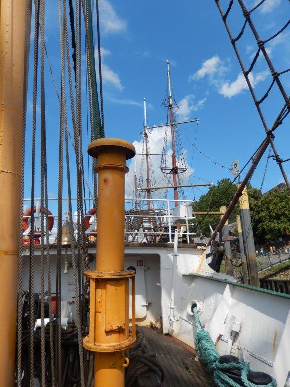
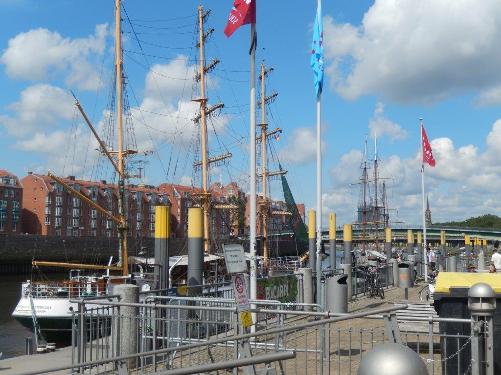
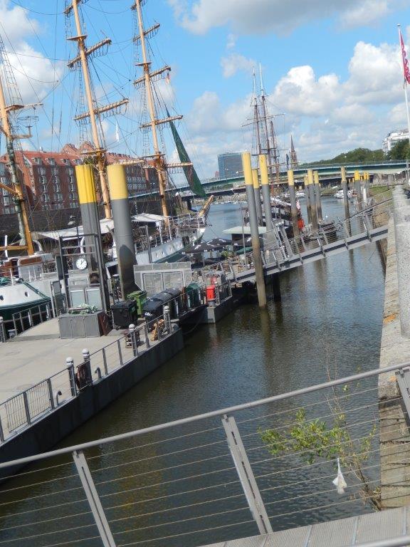
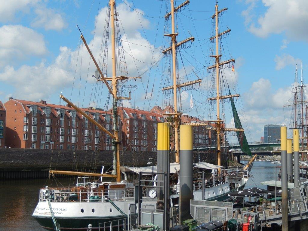
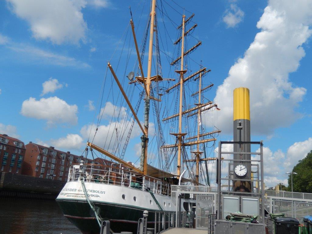
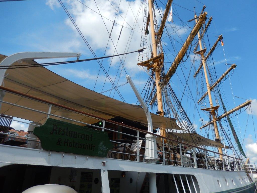
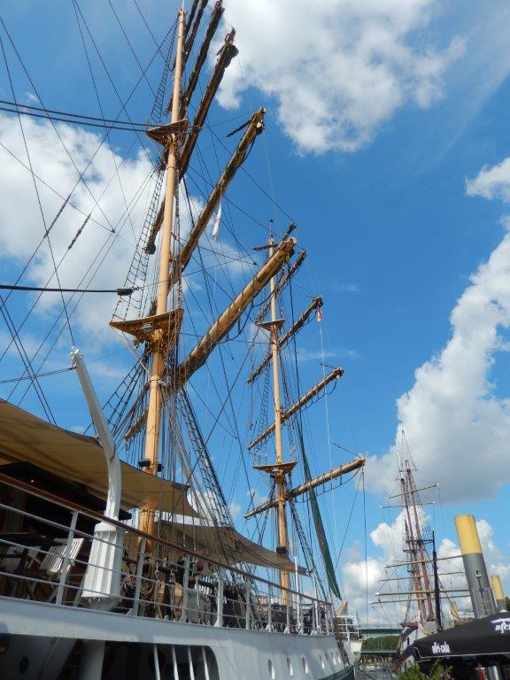
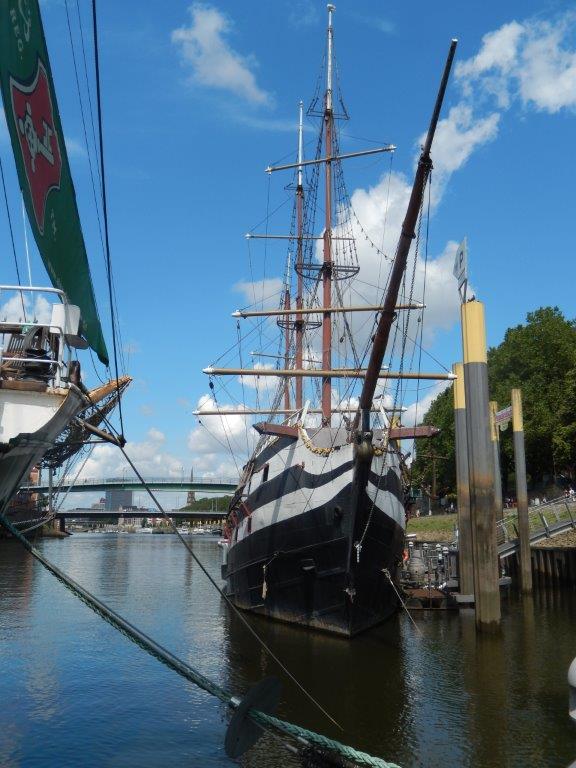
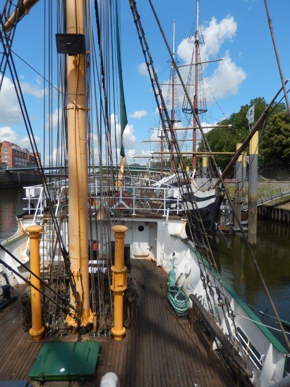
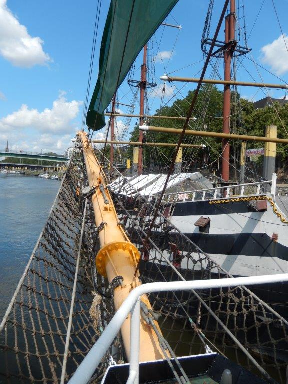
Modernized piers on the Weser now accommodate several ships, including the Friedrich, the Alexander von Humboldt, and the Roland von Bremen, a replica of a 14th-century Hanseatic cog.
The Schlachte was connected to the Teerhof opposite by a newly constructed pedestrian and cycle bridge – the so-called Teerhof Bridge – built in 1993. The Teerhof Bridge is the result of an architectural competition, and the design was by Bremen architect Dieter Quiram.
Within a short time, the Schlachte developed into an entertainment mile, to which, from 2004, the section of the “historic” Christmas market, formerly reserved for the nearby market square, was also extended. The initial fear of a loss of customers, mainly expressed by some market traders based at the market square, proved to be unfounded.
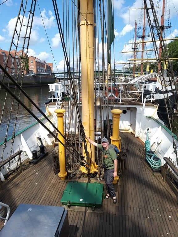
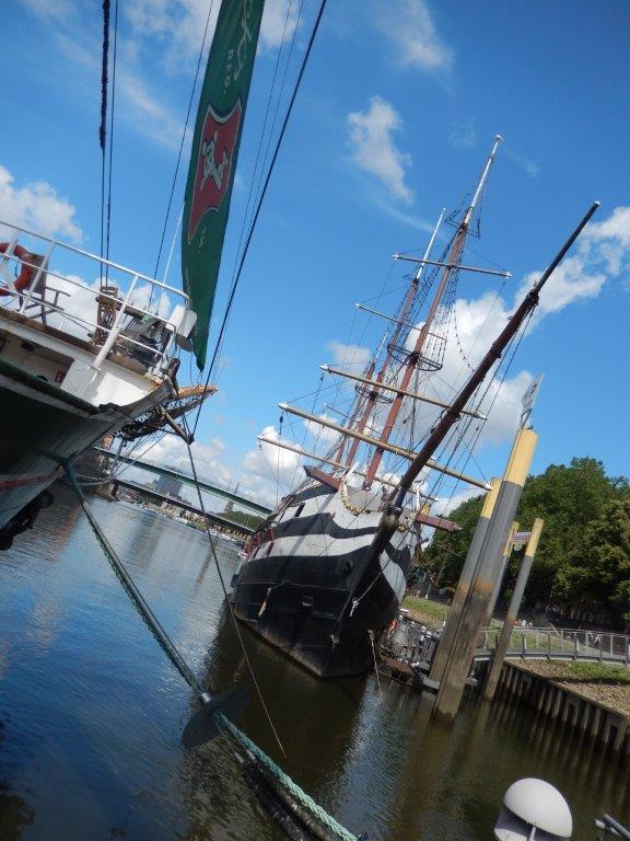
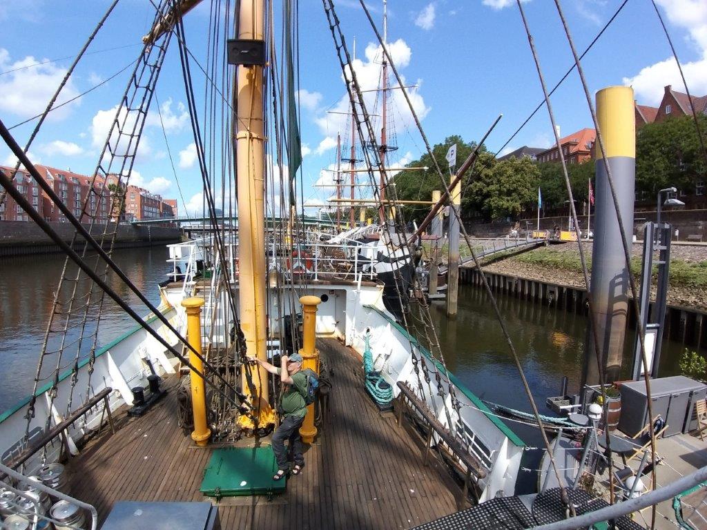
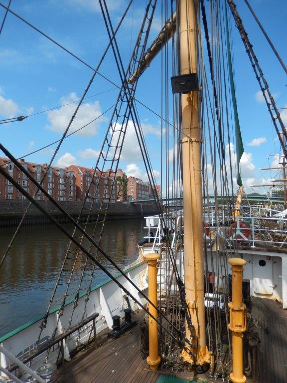
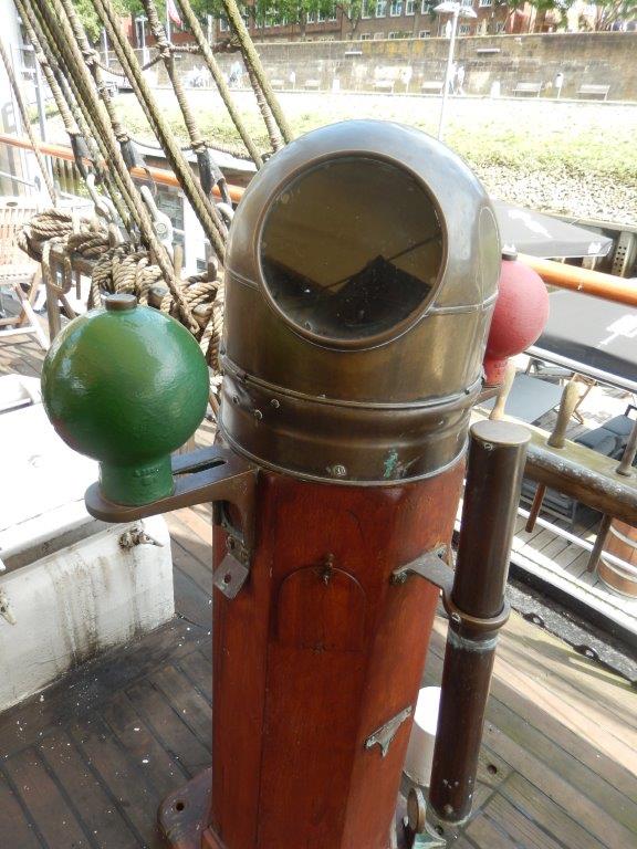
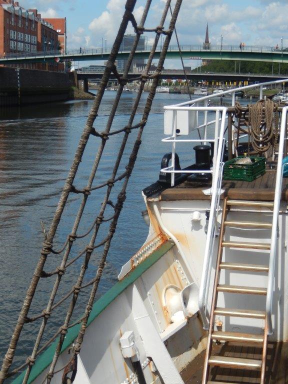
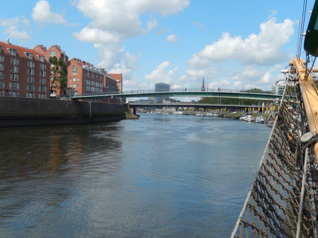
As you probably noticed while reading this history of the Schlachte, the photo’s are those of sail barges found at the quay and while at first enjoying the view on those ships, The Wandelgek soon entered one of the larger ones and had a view on the deck and on the Weser river too. Beneath is an old nautical apparatus for navigation. The small colored balls on both sides are meant to correct the navigation by compensating whenever the ship is not horizontal due to waves and storms. I saw one before in the maritime museum of Ushuaia:
In 2007/2008, the western part of the Schlachte was also redesigned. The urban development measures affected the previously outstanding part of the upper level of the Schlachte, the section downstream of the city center between the Bürgermeister-Smidt Bridge and the Diepenau corner. Following the urban development measures in the Stephaniviertel district and, above all, due to the establishment of Radio Bremen on this part of the Schlachte, the previously existing urban development gap has been closed. The work was completed in February 2008.
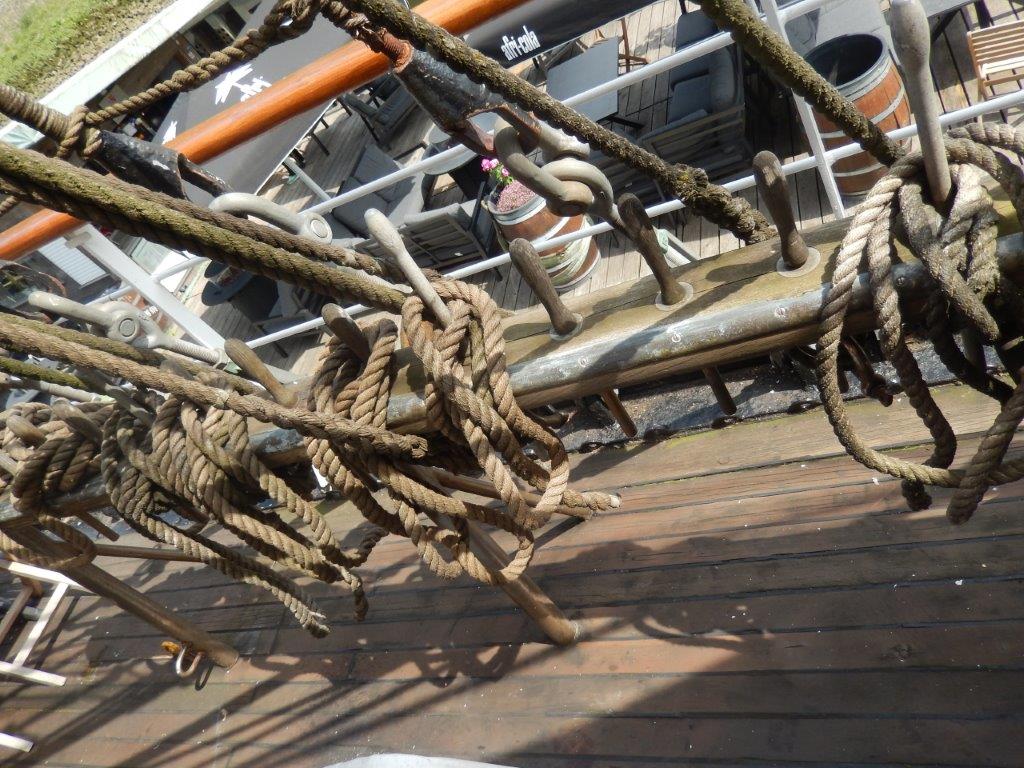
Making a clove hitch, a flat knot, a figure eight knot, a slip hitch and belaying the belay pin are all techniques to use ropes to attach or secure Items when travelling on a ship…
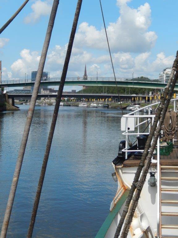
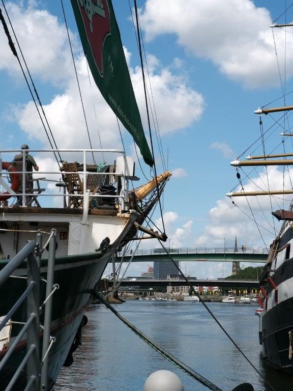
Above two Weser bridges are visible, seen from the ship. The second bridge is the Bürgermeister-Smidt-Brücke, the first is the pedestrian bridge.
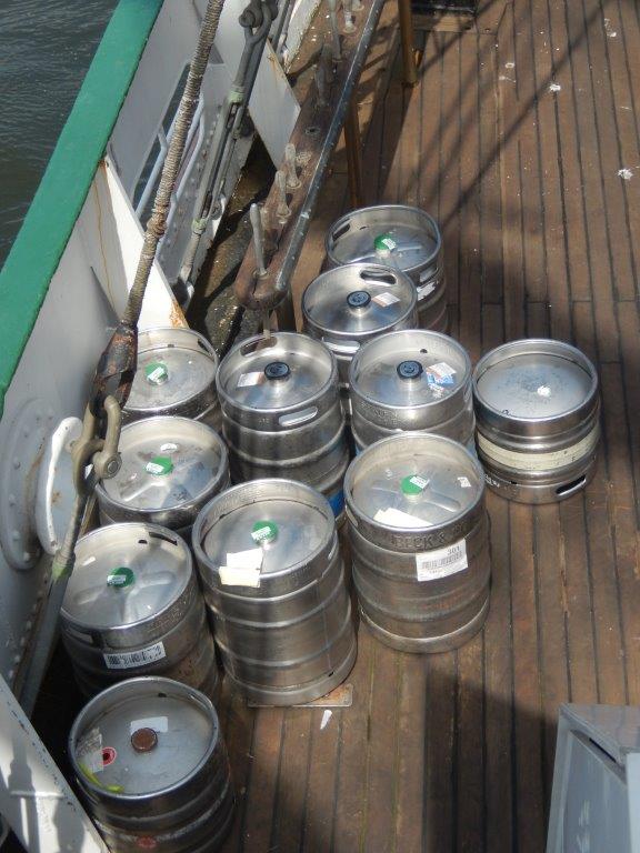
The cargo of this ship was of some importance as it contained some barrels of beer …
The Wandelgek also loved
The Weser is a river flowing northward through the Central Uplands and the North German Plain. It takes its name from Hann. Münden, where its two major source rivers, the Werra and the Fulda, join.
At the mouth of the Weser at the North Sea coast, there are two different boundary lines: The nautical kilometer marking (running downstream) of the Lower Weser ends at the Old Lighthouse in Bremerhaven. The upstream hydrographic station marking, however, includes parts of the Outer Weser and has its origin on the straight line between Langwarden in Butjadingen and the Wurster North Sea coast. The Old Lighthouse is located at kilometer mark 18.2.
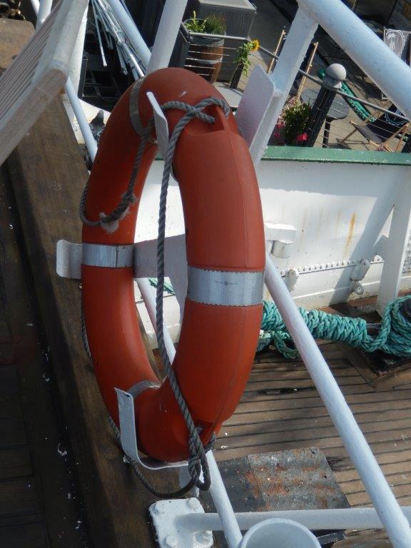
Above the life buoy of the ship in case someone drinks to much beer and falls over board ⛵️🍺🛟😉.
After having visited the Schlachte and the sail ships, The Wandelgek delved even deeper in the once maritime history of Hanseatic Bremen.