
Deventer (the ultimate historic walk for history lovers in 4 parts) Part 1
Deventer 1250
In the year 768 a missionary named Lebuïnus founded Deventer. This is now (2018) exactly 1250 years ago.
The Wandelgek decided to honour the city with an indepth and extensive new historic walk through the old historic town.
What to expect
Don’t expect an article where every historic feat is based upon researched notes. This is not a science or research based blog but a description of a historic walk using several sources as a backdrop, to give you a thorough and a general idea how Deventer developed. If you want to check the historic remarks then use the Sources section at the bottom to research history for yourself. However, I dare say that the general idea of a chain reaction as written down in my Conclusion is correct.
Do expect to get more knowledge of Deventer’s history, like why it was such a large and wealthy town, about its extensive defensive city walls, about its origin and Viking attacks, about it being for decades the seat of 3 Bisshops, of its large year markets and of its membership of the Hanze Trade Union, of it being the cradle of the ideas of Modern Devotion and of Humanism and of its growth and importance as a strategic town and why it bevcame a protector, keeper and spreader of the written word (books)…
Introduction
The very 1st settlements of farmers in the area that is now known as the dutch city of Deventer, were found on three old sand dunes (the orange and yellow) areas in the map below) along the river IJssel. The settlers chose those spots because the river flooded several times a year (the green areas in the map below) and the best spot to keep dry feet and keep the cattle from drowning was on those high dune tops. Why settle there at all? Well the lands boarding the river were among the most fertile lands in the area.
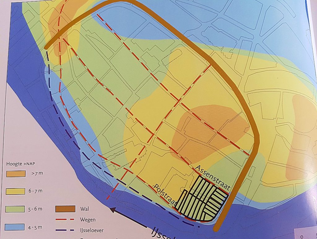
These sand dunes can still be traced in the elevation levels during this walk. In Part 1 of the walk you will visit the dune that’s located at the Noordenbergkwartier (North hill quarter), in the 2nd part you’ll visit the highest dune located at the Bergkwartier (Hill quarter). Both quarters are typical mediaeval town quarters which show a medieaval street pattern. In the 3rd part of the walk you’ll visit the dune located in the area of the Polstraat. Between those three dunes were the low parts which were less used for farm buildings and more for cattle grazing when the river was low and as trading places, like market squares (1st fields of course but later covered with stones). One of those low areas is the current area where the Nieuwe Markt (New Market), Stromarkt (Straw Market) and Grote Kerkhof (Large Cemetry) are located and the 2nd area is where now the Brink is located.
Now we skip a large period and return to Deventer and the river delta area that would eventually become the dutch republic, and we get to the 9th century in which the romans had been driven south and the Empire of Charlemagne was already waning. In those days cities like Amsterdam, Rotterdam and The Hague were of no meaning yet. Two important towns in those days were Utrecht and Dorestad. Utrecht being the largest town in the pre republic area, because it was the seat of a Bisshop and his clergy and Dorestad because it had become the main trade centre in the area due to its position near the shores of the Zuiderzee (Southern Sea (which we nowadays know as the IJsselmeer (IJssel Lake).
Of Vikings and Norsemen
But the waning power of Charlemagne’s Empire meant that others used that as an opportunity to gain wealth. By others I mainly mean the Vikings and Norsemen, sailing south with their Drakkar ships from Scandinavia towards the wealth of Charlemagnes Empire and they discovered it was virtually undefended. They sailed across the Baltic and North Sea and then upstream on the large rivers, deep into the inland. Some sailed acroos the Southern Sea and upstream on the Ijssel river. Others went ashore at Dorestad were they found it totally unprotected due to its economically defined position. Dorestad had never been positioned at a strategical or military defendable location. They plundered and set fire to it several times and people started to abandon it quickly.
The abandonment of Dorestad however, meant that the Vikings and Norsemen landing there, had to shift their attention elsewhere to gain treasure and wealth and the most logical place to shift that attention to was Utrecht. The Bisshop of Utrecht thought of this too and decided to abandon Utrecht which was not defendable either and he 1st chose Saint Odiliënberg tiny Hamlet near Roermond as is seat. Nowadays Saint odiliënberg still is quite small but it has a huge church/cathedral with two humongous towers seen from afar when nearing the village. This church is way to big for such a tiny community, but history as told above explains why it was build there anyway.
But the Norsemen kept advancing into the interior of the delta and they reached the area of the River Maas/Meusse near Roermond. Saint odiliënberg had been save for a while because of its distance from the North sea, but it was never a very defendable location either.
After Dorestad had been ransacked by the norsemen and Vikings, they found that Utrecht was not that interesting anymore after the Bisshop had left, including the Churches wealth. So they searched for other interesting location to plunder and one of those was the Valkhof of Nijmegen, a former Palts or hunting castle used by Charlemagne. They did conquer it eventually but in order to do so they sailed their drakkar ships south over the River IJssel passing Deventer and Zutphen and not only passing them but plundering those little settlements and burning them to the ground. After that they sailed south towards Nijmegen.
The inhabitants of Deventer (and Zutphen) however, did not wait for them to return. They rebuild their settlements and they started creating defenses against the invaders.
One of those defenses was an earth wall with a wooden palisade on top of it and a dry moat in front of it. This and the natuaral defense which the river provided would make it very difficult for the Norsemen and Vikings to conquer and plunder these settlements again. The amount of norsemen and vikings on the relatively small Drakkar ships was not very huge, so they were less likely to attack fiercely defended settlements which would bring them heavy loss of men (which they needed sorely to return them to Scandinavia).
When the Bisshop heard about the city of Deventer and is defense wall against the invaders and when he learned the settlement already had a small church which was left there by Bisshop Laefwin (Lebuinus), he decided to move his entourage to Deventer and for a short but nevertheless important period in history, Deventer became a temporary Bisshop’s seat. Actually 3 bisshops ruled from Deventer, before the third returned to utrecht after the danger caused by the Norsemen and Vikings had waned. Those three bisschops were Odilbald, Radboud and …. .
Bisshops in Deventer
The settlement of the Bisshop and his large entourage in Deventer meant that the buildings where they had to live, pray, learn and rule had to be build and these were not simple wooden farm buildings, but buildings of stone with more luxury added. A large area of the old town was reserved for the followers of the Catholic church. Nowadays we can see the remains of this area stretching from the Groote Kerkhof via the Sandrasteeg and the Lamme van Diese square towards the Broederenkerk and the area Achter de Broederen. This large area once was completely reserved for the Bisshop’s and their entourage and there was even talk and planning of digging a moat around this area to defend it. This moat did eventually appear many years later, surrounding a much larger area of the town.
The inner moat
The Binnengracht (Innermoat) as this moat was named many years later after the city succesfully became an important member of the Hanze trade Union and expanded and needed a second Outer moat), has been drained in the Industrial era, because it bore a horrific stench into town and caused dissease, because people dumped all sorts of garbage in it and used it as an open sewer. It has now completely vanished, but there are still lots of traces to be found within the present city of Deventer.
The city of Deventer was threatened by the Norse invasions, but eventually this strengthened its position as a temporary Bisshop’s seat and as the most important trade town in the Netherlands before the rise of Amsterdam. In that period only Utrecht remained larger in population.
The earth wall was replaced by a stone wall and later even by a double stone wall and in both walls were gates, meaning that of alot of gates there were an inner and an outer version, like e.g. the inner Bergpoort and the Outer Bergpoort, or the Inner Vispoort and the Outer Vispoort.
But as the years passed, modern warfare became more capable in destroying these brick stone walls and the invention of the canon made them obsolete. Maurits and his State Army, conquered Deventer after he blew some large holes in the outer and inner city walls, using canons (this happened at the Zandpoort).
The outer moat
Deventer kept changing loyalties or got conquered by sometimes the Spanish Army and sometimes the Replubic Army, but when the Republic grew more and more into a real country, Deventer was permanently conquered. Its location was of the utmost importance to the Republic but also to every invading army. At Deventer it was easiest to cross the river IJssel and push through towards Utrecht and Holland. That’s why Maurits decided to strengthen or better renew/modernize the Deventer defensive city walls. A new much stronger defensive circle was created around the Inner walls, which were not torn down but remained.
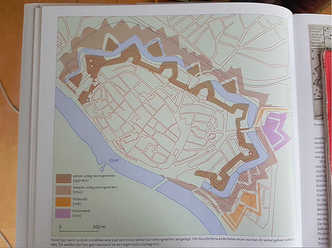
Around this new defensive system consisting of new stronger walls and 7 bastions placed strategically around the city on the land side. Around this wall a new wider moat was dug and in this moat, placed between the bastions, small ravelin islands were constructed as defense. The current Vogeleiland was such a ravelin. The city, in practice, became the capital of the east. The most important town and tool from where to control Overijssel.
The Walk
This walk will guide you and provide you with some more interesting information of the Outer and Inner moats of Deventer and you’ll also get to the area where the Bisshop’s and their entourage resided and ruled. Finally I will provide a list of sources in which the interested reader will find even more about the history of the beautiful Hanseatic Town.
Start of the historic walk
Part/Map 1: Stationsplein –> Vogeleiland –>Oude Plantsoen–> Drakenbrug –>Noordenbergsingel –.>Parkweg–>Kapjeswelle Graaf van Burenstraat–>Molenpad–> Part/Map 2: Stenen wal–> Noordenbergschild–> Graaf van Burenstraat–> Gibsonstraat–> Binnensingel–>Badhuisstraat tot aan Smedenstraat–>Terug naar Binnensingel–> Brinkpoortstraat–> Brinkpoortplein–>Brinkpoortstraat–>Gedempte Gracht–> Pikeursbaan–> Geert Grootestraat–> Walstraat–> Damstraat–> Pikeursbaan–> Houtmarkt–>Emmaplein–>Kazernestraat–>Emmaplein–>Emmastraat–>Bergschild–>Stairs–>BergKerkplein–> Roggestraat –> Part/Map 3: Brink–>Bergstraat–> Bergkerkplein–>Kerksteeg–>Bergschild (City Wall)–>Menstraat–>Brink–> Rijkmanstraat–>Muntengang–> Achter de Muren Zandpoort–> Zandpoort–>Boterstraat –> Brink–> De Heks–> Polstraat–>Manhuissteeg–>Achter de Muren Duimpoort–>Duimpoort–> Sint Janssstraat–> (Walk around) Groote Kerkhof (throwing a glance at the Lange Bisschopstraat)–>Waterstraat–>Vispoort–> Nieuwe Markt–>Dikke van Dale–>Achter de Muren Vispoort–>Kranensteeg–> Noordenbergstraat–>Klooster–> Tibbensteeg–> Nieuwstraat–>Stromarkt–> Graven–> Nieuwe Markt–> Hofstraat–> Kleine Poot–> Part/Map 4: Sandrasteeg–>Lange Bisschopstraat–>Kleine Overstraat/Jordenshof–>Spijkerboorsteeg–>Grote Overstraat–>Pontsteeg–>Lamme van Dieseplein–> Engestraat–> Achter de Broederen–> Smedenstraat–> Korte Bisschopstraat–> Brink–> Keizerstraat–> Stationsplein
Route and Map Part 1
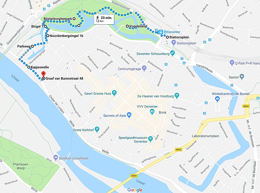
Part/Map 1: Stationsplein –> Vogeleiland –>Oude Plantsoen–> Drakenbrug –>Noordenbergsingel –.>Parkweg–>Kapjeswelle Graaf van Burenstraat–>Molenpad–>Part2/Map2
Route Description Part 1
![]() We start walking in front of the Deventer Railway Station.
We start walking in front of the Deventer Railway Station.
Deventer Railway Station and Station Square
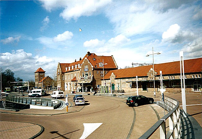
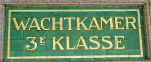
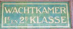
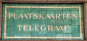
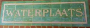
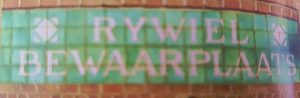
The station is worth getting a closer inspection. Here are some examples you’d mind want to track down 🙂
Deventer is a railway station in Deventer, Netherlands. The station was opened on 5 August 1865 and is on the Apeldoorn–Deventer railway, Deventer–Almelo railway and the Arnhem–Leeuwarden railway. The train services are operated by Nederlandse Spoorwegen.
The station has good connections into all directions, North, West, South and East.
The buildings of the station consist next to the main entrance building of a railway water tower and platform buildings.
 The current main building is from 1914. The station buildings are a great example of only a few remaining early 20th century station buildings left in the Netherlands and there are many details to observe that remind us of a time long gone…
Beneath is a video in Dutch about the Railway Station of Deventer, created when the station was 100 years old in 2020.
![]() After leaving the right front entrance of the main building, walk straight forward to the edge of the road and cross the road. Then turn right on the pedestrian sidewalk. Turn left when you see a dirt track and follow this until you can go left again, crossing a small bridge onto an Island. Have fun visiting the Island, its restaurant and the small zoo, or follow the dirt track around the Island (immediately right after leaving the bridge). Return to this bridge when you’ve finished.
After leaving the right front entrance of the main building, walk straight forward to the edge of the road and cross the road. Then turn right on the pedestrian sidewalk. Turn left when you see a dirt track and follow this until you can go left again, crossing a small bridge onto an Island. Have fun visiting the Island, its restaurant and the small zoo, or follow the dirt track around the Island (immediately right after leaving the bridge). Return to this bridge when you’ve finished.
Bird Island and The Mandala/Vogeleiland en Mees (in De Mandala)
 Bird Island/Vogeleiland is the old leftover ravelin number 3, from the outer defenses of medieval Deventer. It has a delightful small zoo with mainly birds in cages, but also walking freely on the grass and in the bushes.


There’s a beautiful restaurant overseeing the outer moat and the old town and a peaceful walking path along is edge.
See my blogpost on culinary Deventer:
![]() Cross the bridge and immediately turn left on a dirt track parallel to the moat. The track will join the sidewalk after a few meters. Again after a few meters, a tarred path leaves the sidewalk going left. Follow this path and keep the moat left to you. Neglect all side paths.
Cross the bridge and immediately turn left on a dirt track parallel to the moat. The track will join the sidewalk after a few meters. Again after a few meters, a tarred path leaves the sidewalk going left. Follow this path and keep the moat left to you. Neglect all side paths.
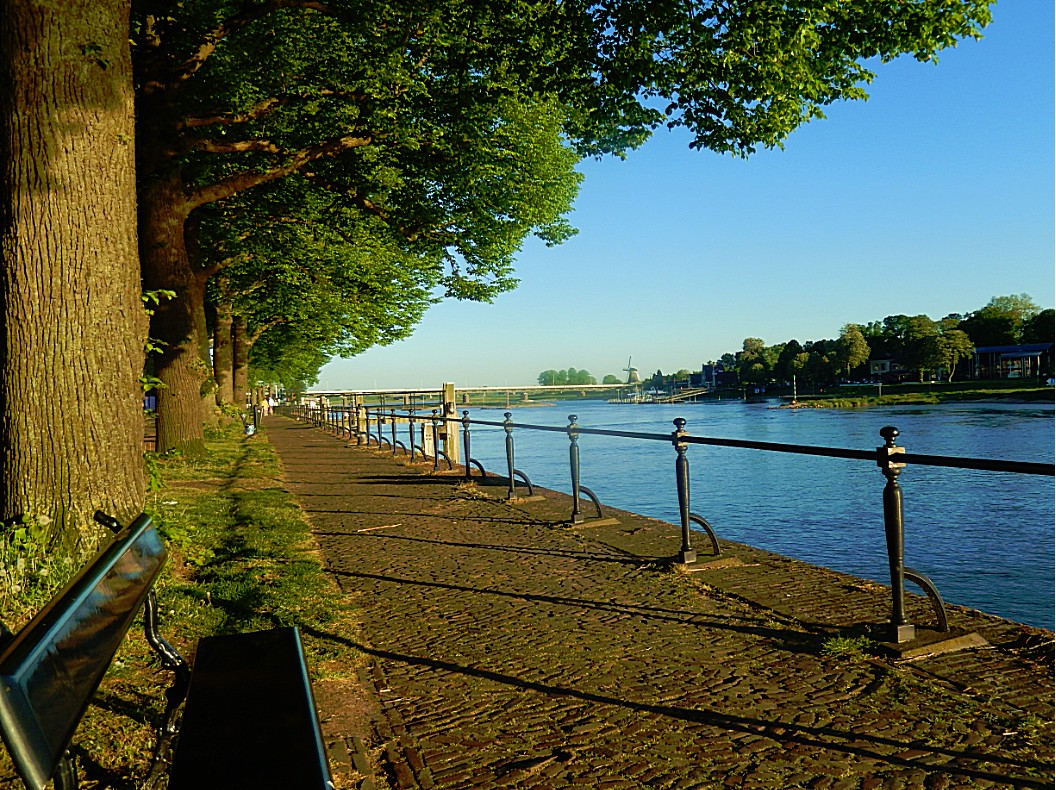
Outer Moat/Buitengracht
The outer  moat/buitengracht still surrounds all of the Deventer historic city center (except for a small part at the Railway station, where the moat was drained because of an underground bicycle garage. Ah yes: The Dutch and their bicycles 😉 There were bastions in this moat to defend the town from invaders and on the inside of the moat was a defense wall with lots of defense turrets and town gates. Nothing physical of that era remains, but e.g. street names do give clues about the past of Deventer as a fortress town.
![]() Keep following the path nearest to the water on your left. You’ll pass the fountain (in spring and summer). The path will retreat from the water and walk around a high hill. Left you’ll see a stone stair going up. Climb that stair and on top go left. To the left you”ll get a splendid view over the Outer moat, the park and the historic town center. Keep following the path as it descends towards the moat and stay on the path keeping the moat to your left.
Keep following the path nearest to the water on your left. You’ll pass the fountain (in spring and summer). The path will retreat from the water and walk around a high hill. Left you’ll see a stone stair going up. Climb that stair and on top go left. To the left you”ll get a splendid view over the Outer moat, the park and the historic town center. Keep following the path as it descends towards the moat and stay on the path keeping the moat to your left.
The Old Park/Het Oude Plantsoen
 The name “The Old Park” suggests that there’s a “New Park” too and so there is. But to make things complex: There’s an even older park too :-). Deventer is the proud owner of 3 historic parks, of which 1 is the oldest wander park in the Netherlands. I’m talking about the Worp Park/Worp Plantsoen which was mentioned in old descriptions going back in time as far as 1699. A few years after the French occupation of The Netherlands had ceased, this park was restored. In 1813 when Deventer was still occupied, the French army decided to remove all buildings and trees from the western riverbank of the IJssel river, to have a clear unobstructed view on the advancing Kozak army. After the occupation in 1815, Willem I gave permission to restore the park, under condition that if new war threaths occurred, the park would be levelled again.
The Old Park (or Rijs terborger Park/Rijsterborgerplantsoen) which we now enter is much less old than the Worp Park. When the town of Deventer started to grow at the end of the 19th century, due to the Industrial Revolution, its defensive walls which had protected it for so long, 1st against the Vikings and later against other invaders, had to be dismantled, because now they obstructed the cities growth. In 1874 the Rijsterborgerpark or Old Park was build upon the remains of the old fortress of Deventer, but already 1852 a short walk named the Rijsterborger path was mentioned going from the Noordenberg gate to the Brink gate.

 The park was designed bij famous garden architect Leonard Anthony Springer in 1887, after the fortress of Deventer was abolished in 1874. Leonard Anthony Springer was also the architect of the famous Vondel Park in Amsterdam. In 1968, The Old Park was given the status of national monument (this status was also given to the Vondel Park).
The New Park which I mentioned before was constructed in 1893, again by Leonard Anthony Springer.
Dragon Bridge/Drakenbrug
 Near the Dragon bridge/Drakenbrug is a statue of Europe and the Bull bij Pieter d’Hondt. Scattered around the Park, are several art statues, theres a fountain in the moat and a music dome, small zoo with mainly birds and restaurant on Bird Island.
Dragon Bridge has nothing to do with dragons, but the faces of what seem to be Ogres or Gargoyles on the bridges arc, did remind people of dragons.
This bridge was once less wide and used by pedestrains and cyclists only.
![]() At the end of the tarred path at the Dragon bridge, go left and cross the bridge. Immediatly after crossing the bridge, cross the road (Singel).
At the end of the tarred path at the Dragon bridge, go left and cross the bridge. Immediatly after crossing the bridge, cross the road (Singel).
Singel and Noordenbergsingel

 In English “singel” could be translated as Girth, or Boulevard, meaning a road walking on the edge of a moat, canal or a ditch. And that is exactly what this singel is. On older maps of Deventer you’ll see that the current Singel did not cross the Dragon Bridge but kept following the moat until it reaches the River IJssel. With the Industrial Revolution, its inventions of transport like the car and the train came to Deventer and this made it necessary to widen the Dragon Bridge for cars to cross it and to make a viaduct tunnel through the Railway dam. The road crossing the bridge and going through the viaduct, was the new extension of the Singel. The part going to the river now needed another name and was named after the historic town quarter (Noordenbergkwartier) which it skirted. Its new name was Noordenbergsingel.
![]()

 After crossing the Singel, go left and immediately right with the water of the moat now immediately to your right. After a few metres a dirt path starts. Follow this until you reach a tarred road going right (Parkweg). Go left, cross a small dam onto an Island and keep following the Parkweg (Park Road) to its end).
Parkweg/Island
 The Parkweg crosses a small Island which in 1874 was appointed as a residential area. Leonard Anthony Springer, the architect of the Park we just left, had hoped that the city counsel would appoint him as achitect of this aea too, because it was similar in landscape as the park area, but they didn’t. But when he had finished the Park, the residents of this area were so impressed that they contracted Springer and he created a Park like residential environment between the Old Park and the River IJssel. The island is probably the remainder of a ravelin from Deventers defense works.
Kapjeswelle and Onder de Linden
You’ve now reached the River IJssel, which runs north as a division of the River Rhine at Arnhem, passing the Hanseatic towns of Zutphen, Deventer, Hathem, Zwolle and Kampen, towards its mouth in the IJsselmeer.
It’s the life source of Deventer and it was very important for its economic development and its defense, but it brought dangers too, like yearly floods and invaders from the north.
 In mediaeval Deventer, we would now be outside the city walls. The outer moat and the outer city walls described before, did not exist yet but were build after the Middle Ages in the 16th to 18th century. We would now stand in a low area where there were some trees and people liked walking here. It was named: “Onder de Lindekes” (Beneath the Linden trees) because of the Linden trees growing here. The road in front has a beautiful sidewalk on the riverbank underneath Linden trees too. Its name is still Onder de Linden and every year on the 1st Sunday of August, the largest open air bookmarket in Europe (bearing a length of above 6 kilometres) is held here. Another thing the mediaeval inhabitant of this city would notice was the high city wall and defense tower. These were build upon the top of the 1st of the three sand dunes were Deventer began. The top of this dune is can nowadays be noticed in the elevation and i
 t is located at the end of the Molenstraat, (Korte) Noordenbergstraat, Noordenbergschild, Papenstraat/Bruijnsteeg, Gibsonstraat, Graaf van Burenstraat, ending just before the Binnensingel. This defensive construction was called the Graaf van Buren Bastion. The current Graaf van Burenstraat (Earl/Count of Buren street) reminds us of this. In the 16th century, work began on the construction of a second defense system around the town, creating more space for citizens and a stronger defense against invaders. These defenses included a double city wall and an outer moat, build in a bigger circle around the existing inner moat and inner city wall. We now enter the historic mediaeval city centre at the Noordenbergkwartier.


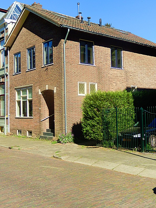
![]() After you reached the end of the Parkweg, go left on the sidewalk. Cross the Van Twickelostraat and cross the Graaf van Burenstraat. Go left into the Graaf van Burenstraat for a few metres until you see this house and go right on the narrow alley.
After you reached the end of the Parkweg, go left on the sidewalk. Cross the Van Twickelostraat and cross the Graaf van Burenstraat. Go left into the Graaf van Burenstraat for a few metres until you see this house and go right on the narrow alley.
Mill path/Molenpad

 The Molenpad is a narrow alley way of a considerable length, going at first between the houses of the Graaf van Burenstraat and the much older houses on the mediaeval Molenstraat. It then crosses the Molenstraat and runs further between the backside of houses of the Molenstraat and the Papenstraat until it ends at the Lindenstraat.
![]()
 Follow the Molenpad until you reach a T-crossing with an underpass to the right leading to the crossing of the Molenstraat and a stone stair to the left leading up. Go left and climb the stairs to the top. Proceed to Route and Map part 2.
Deventer (the ultimate historic walk for history lovers in 4 parts) Part 2