
Deventer (the ultimate historic walk for history lovers in 4 parts) Part 3
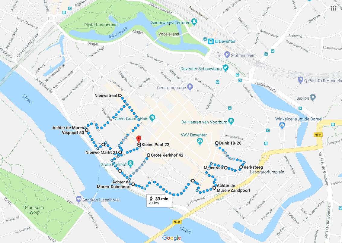
Route and Map Part 3
Part/Map 3: Brink–>Bergstraat–> Bergkerkplein–>Kerksteeg–>Bergschild (City walls)–>Menstraat–>Brink–> Rijkmanstraat–>Muntengang–> Achter de Muren Zandpoort–> Zandpoort–>Boterstraat –> Brink–> De Heks–> Polstraat–>Manhuissteeg–>Achter de Muren Duimpoort–>Duimpoort–> Sint Janssstraat–> (walking around) Groote Kerkhof (throwing a glance at Lange Bisschopstraat)–>Waterstraat–>Vispoort–> Nieuwe Markt–>Dikke van Dale–>Achter de Muren Vispoort–>Kranensteeg–> Noordenbergstraat–>Klooster–> Tibbensteeg–> Nieuwstraat–>Stromarkt–> Graven–> Nieuwe Markt–> Hofstraat–> Kleine Poot–> Part/Map 4
![]() Starting at the end of the Roggestraat and facing The Brink, turn left and after a short walk right into the Bergstraat. Ascend the cobbled street until you reach the Upper Bergkerkplein.
Starting at the end of the Roggestraat and facing The Brink, turn left and after a short walk right into the Bergstraat. Ascend the cobbled street until you reach the Upper Bergkerkplein.
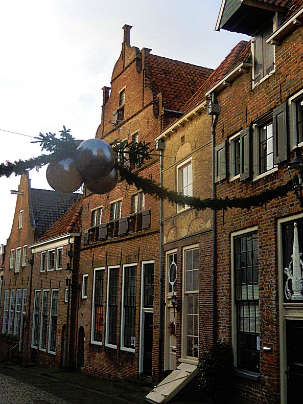
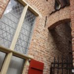
Bergstraat

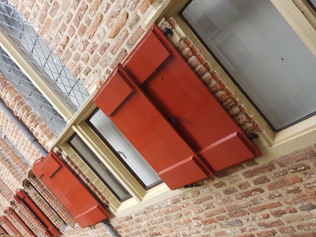
 The Bergstraat is the steepest ascend to the top of the former sand dune. It leads towards the Upper Bergkerkplein. The street is packed with beautiful monuments, restored between 1967 and 1969. Enjoy the monuments and the view up towards the Bergkerk. The street shows quite well how uncommonly wealthy the city had become when it was one of the main Hanseatic towns in Europe and the main hanseatic town in the Netherlands. A bit before reaching the top, you’ll see on your right the by Claus van Amsberg unveiled memorial on the wall of Bergstraat 37-39. It presents Nicolaas van Myra who pays a bag of subsidy money in the Bergkwartier. This was actually the money for the renovation of the Bergkwartier.


![]() Cross the Upper Bergkerkplein and go right into the descending Kerksteeg. Follow the Kerksteeg until it ends at the Bergschild.
Cross the Upper Bergkerkplein and go right into the descending Kerksteeg. Follow the Kerksteeg until it ends at the Bergschild.
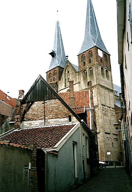
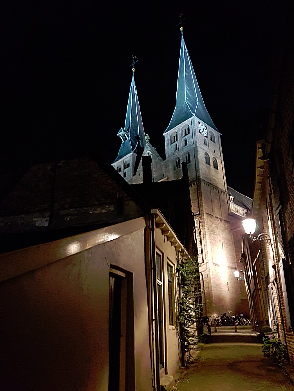
Kerksteeg
When walking down the cobbled stones of the Kerksteeg, do not forget to turn around a few times, becausethe view is extremely photogenic 😉


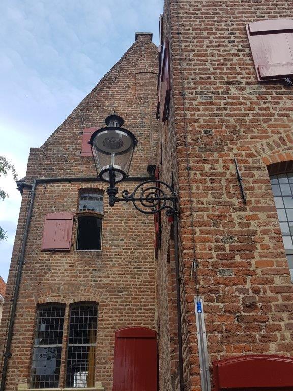
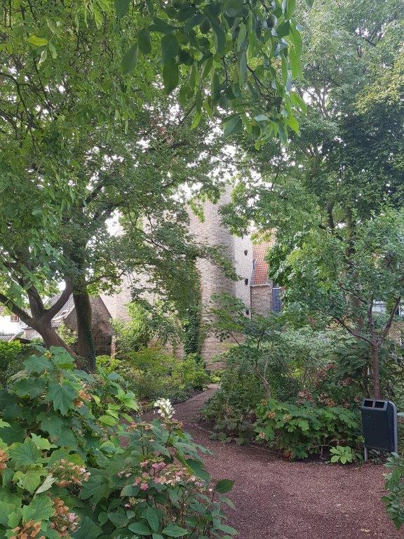
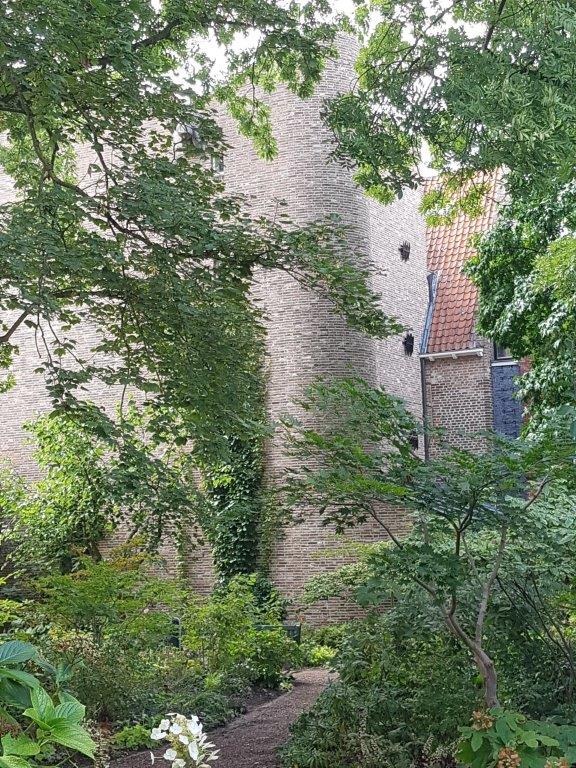
Bergschild
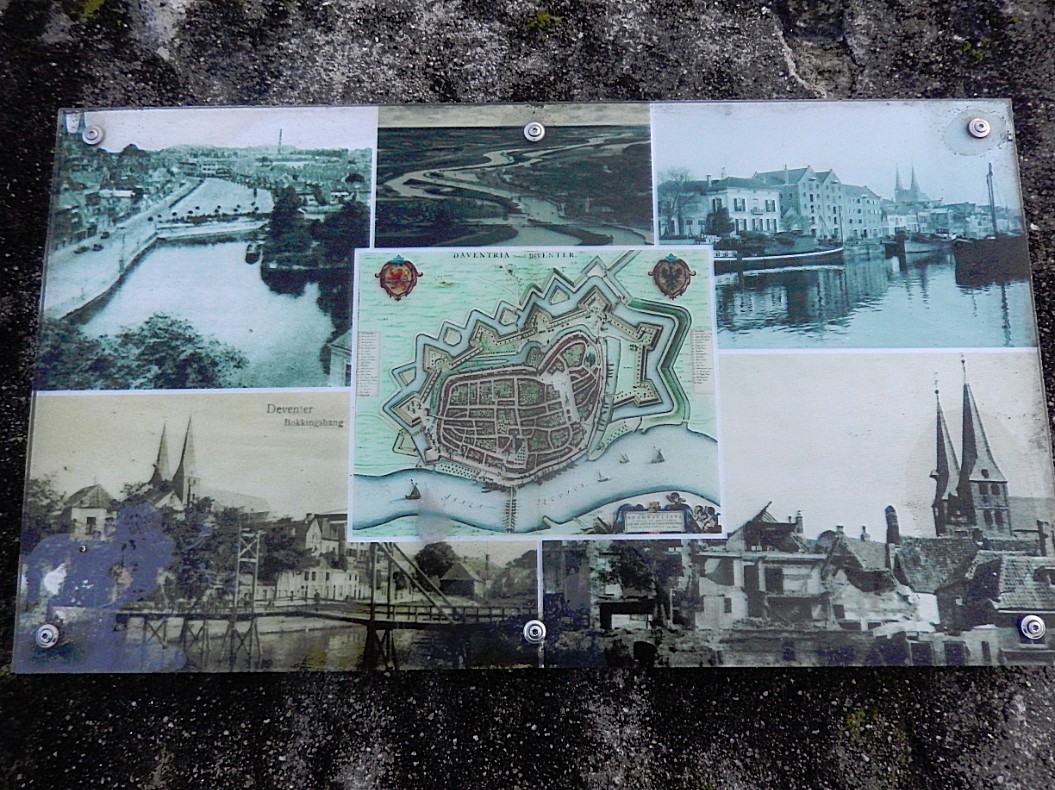
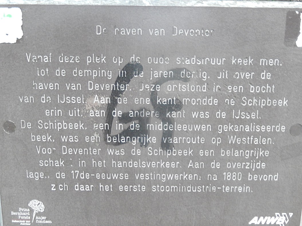
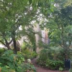
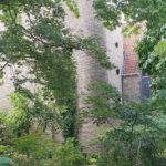
Tthe Bergschild is also a location packed with beautiful monuments. Cross the Bergschild towards a little fenced children’s playground. Go through the fence if it is open and proceed towards the edge of the city wall. From here you’ll have a great view over what once was the old harbour of Hanseatic Deventer. There are some information tableaus showing pictures of the harbour. From here goods were unloaded and transported towards the Brink where they could be weighed at the Waag and traded on the market.


![]() Return to the Bergschild and walk towards the entrance of the Kerksteeg. Just before entering the Kerksteeg turn left into the descending Menstraat. Follow the Menstraat until it ends on the Brink.
Return to the Bergschild and walk towards the entrance of the Kerksteeg. Just before entering the Kerksteeg turn left into the descending Menstraat. Follow the Menstraat until it ends on the Brink.
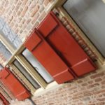
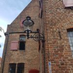
Menstraat
Enjoy this street full of wonderful monuments from Deventer’s heydays as an important member of the Hanse city trade union. Menstraat means Steering, driving or guiding street. It refers to steering/driving/guiding of horses. I’ve mentioned horses before and that’s because in hanseatic/mediaeval Deventer, those were important for transportation, plowing agricultural land and warfare.
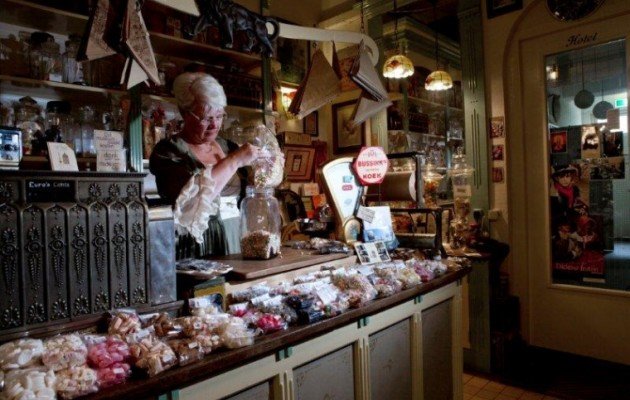
Broom and duster shop
A bit before reaching the end of the Menstraat is on your right a little shop selling all kinds of brooms. This is also a beautiful photogenic shop to enter and view its interior. The brooms are created from every kind of hair that you can imagine. I’m talking abot badger hair until whale baleens.
![]() Turn left on the Brink.
Turn left on the Brink.
Brink
On this part of the Brink which is near to the former Zandpoort (Sand gate) and the old harbour and the river IJssel, you’ll have a brilliant view on the Waag.
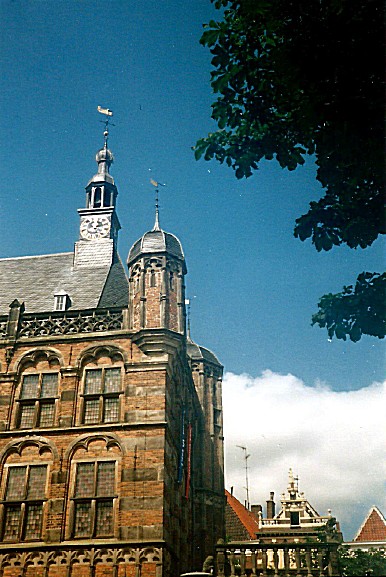
Waag
De Waag is a weigh house on the Brink in the center of Deventer. It is the oldest venture building in the Netherlands that was built as such.
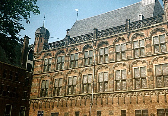
 It is a late Gothic building with three storeys, a staircase tower, a clock and three spiers. It was built from 1528 to 1531. In 1643 a late mannerist platform with three columns was built at the front. There are stairs on both sides. The building was used as a weigh house until 1862, after which a school was established.
At the entrance to the platform there are two sandstone lions and the façade is decorated with the relief stones Kiek in de Pot and Morgenster, which remind of the threatening reinforcements of the Duke of Gelre on the other side of the IJssel. A bronze cauldron from 1434 hung on the façade for centuries, in which counterfeiters were boiled alive in the oil. This occurred among others in 1434 to the coin master Mr. van Batenburg on charges of counterfeiting. A recent condition check showed that it was no longer sensible to leave the copper kettle hanging outside. Since 2017, the boiler has therefore been moved to the front porch of the weigh house and can be visited there without any obligation of buying a museum ticket. The holes that can be seen in the boiler were shot in 1813 by shooting soldiers from the occupying Napoleonic army.
The building is leaning towards one side, it is about 80 cm from being straight. That is why it was provided with new foundations in the nineties.
From 1915 a museum was established in the Waag. Since 2015, the museum has been called ‘Museum De Waag’, formerly ‘Historisch Museum Deventer’. In addition to important pieces from the Deventer historical collection, there are changing exhibitions with a specific theme. These are organized by the organization Deventer story.
Website: http://museumdewaag.nl/
On the top floor is a display which explains the destructive power of the great city fires.
The museum is absolutely worth spending an hour or more of your time.
![]() Turn left into the Rijkmanstraat.
Turn left into the Rijkmanstraat.
Rijkmanstraat
 Rijkmanstraat means in English Rich or Wealthy men’s street. And although this part of the Bergkwartier was very heavily damaged by Worl War II bombardements, and most of the beautiful buildings are gone, it does boast at least one extremely beautiful monument on the left of the street, shortly after leaving the Brink.
![]()
Look right for a narrow alley named Muntengang and enter this cobble stone paved alley. Follow it until you reach a small square.
Muntengang/Muntentoren

 The Muntengang (Coin alley) leads to the Muntentoren (Coin Tower). In Deventer, royal coins were minted at the end of the 10th century, from 1046 on they became episcopal coins. The right to coin was a right that only real wealthy places obtained and could exercise. Of the more than 9000 coins from the period 1040-1100 found in the current Netherlands and East Friesland, no less than 1639 coins came from Deventer. Deventer coins from later periods have been found in excavations across the entire area of the Hanseatic League. Until the introduction of a national currency in the early 19th century, the last Deventer coin arrangement was located in a building between the Rijkmanstraat and the Zandpoort, the Muntentoren. Especially in the 11th and 12th century Deventer was one of the most important trading places in what is now the Netherlands.

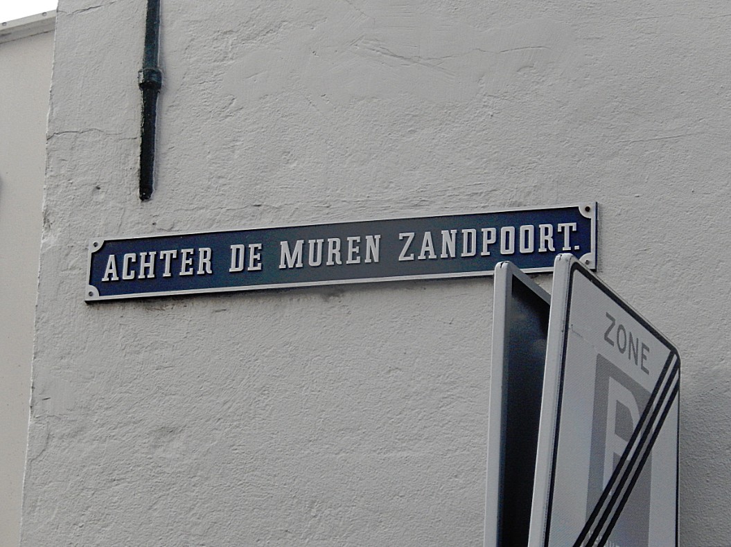
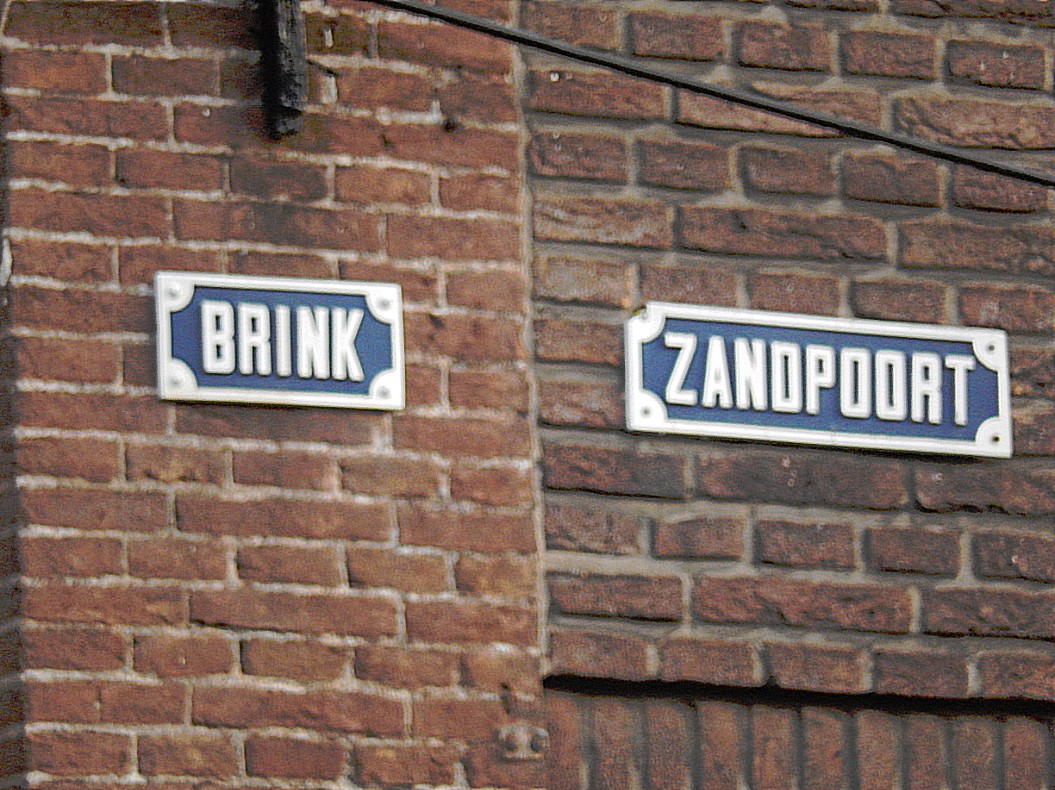
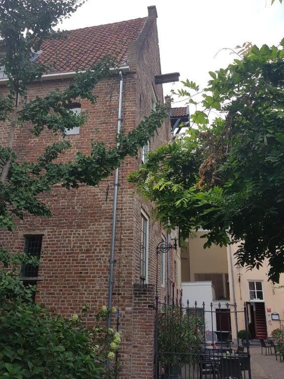
![]() Leave the small square through a tiny arched gate and go left towards the road. This is Achter de muren
Leave the small square through a tiny arched gate and go left towards the road. This is Achter de muren  Zandpoort.
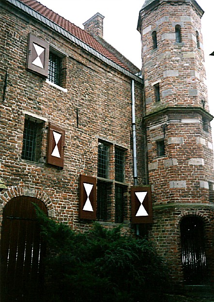
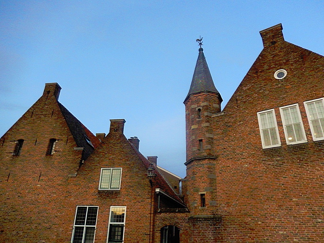
Achter de muren Zandpoort
Deventer has quite some city wall remains. We’ve seen the largest part from the Kazernestraat and on top of the Bergschild, but there are less and more hidden parts to be found. There are three streets in Deventer that are named Achter de muren (meaning Behind the City Walls), and added to their name is the name of the city gate located nearest to the street. In this case it is the Zandpoort (Sand gate), which we’ll visit next.
Cross the street towards the gallery. Look through its windows (or better visit the gallery) and you’ll see remains of the city wall and a defense tower. Their are informative tableaus hanging behind the windows.
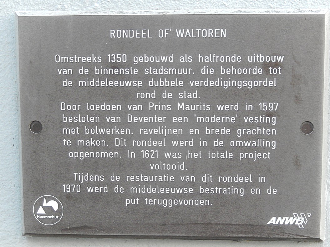
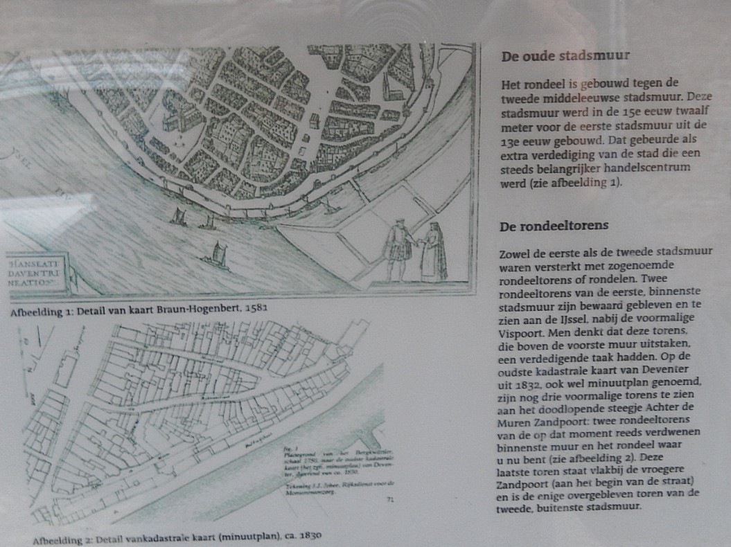
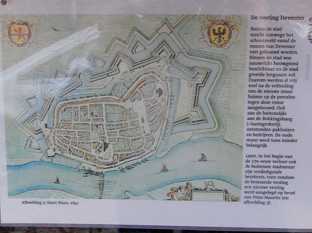
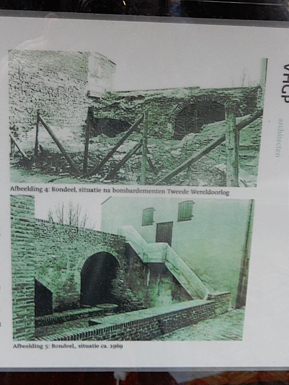
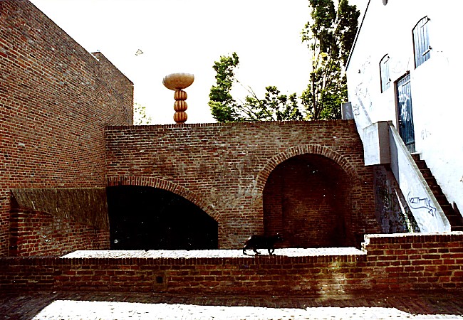

Website: https://www.rondeeldeventer.nl/
![]() Facing the gallery turn right. Follow the road until you reached the Zandpoort. Turn right. You have now left the Bergkwartier.
Facing the gallery turn right. Follow the road until you reached the Zandpoort. Turn right. You have now left the Bergkwartier.
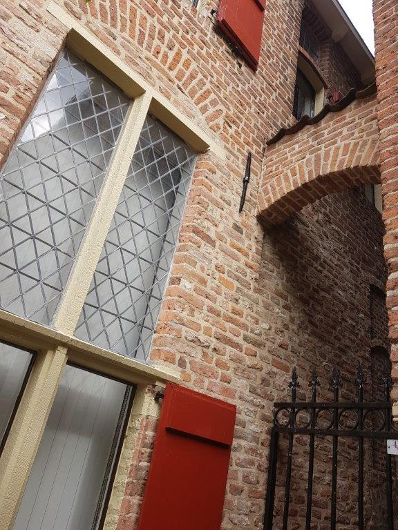
Zandpoort
The Zandpoort (Sand gate) was a former medieval city gate of the city of Deventer. The gate was built in 1394. The gate formed the southwestern gateway to the city. At the Zandpoort there was also a toll-house where the Katentol (named after the Katerveer south of the city of Zwolle), had to be paid.
During the siege of 1578 under the leadership of the Count of Rennenberg the city walls were fiercely attacked. As a result, the Zandpoort lost its pinnacle and four corner towers.
In 1591 another siege took place on Deventer, this time by the State army under the leadership of Prince Maurits. On June 9, 1591, Maurits had the southern city wall massacred with cannons from sunrise. The Zandpoort again suffered a lot of damage under the heavy bombing. In addition, a breach was created in the city wall, allowing attackers to enter the city. Although an action by the State army to invade the city failed, the city surrendered not much later.
De drie Haringen and De rode Leeuw
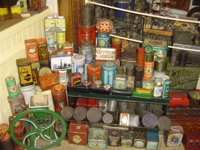
 Just across the street are two very old buildings (even old for Deventer) of which De drie haringen (the three herrings) is the oldest. You can recognize the buildings from hanging sign boards depicting three herrings and a red lion. The three herrings nowadays houses the Speelgoed- and Blik museum which shows a lot of the history of toys through the ages and has a wonderful collection of magic lanterns, china dolls a miniature railway and a great collection of tinplated conserves, which were created in Deventer after the Industrial Revolution.
Website: https://www.speelgoedmuseumdeventer.nl/
![]() Walk towards the Waag and the Brink, but turn left into the Boterstraat (Butter street). Proceed to the end of the street.
Walk towards the Waag and the Brink, but turn left into the Boterstraat (Butter street). Proceed to the end of the street.
Boterstraat
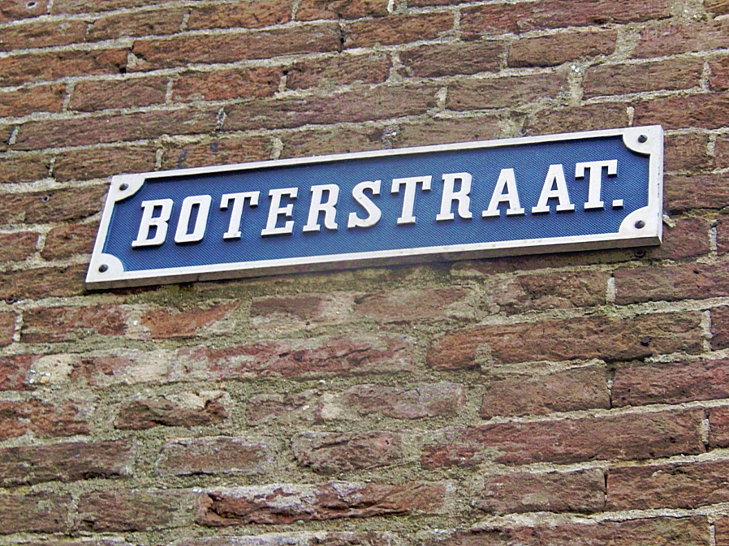

 The Boterstraat is like the Roggestraat, Houtmarkt and Beestenmarkt a street named after commodities that were traded in Mediaeval/Hanseatic Deventer. The street is again packed with beautiful monuments.
![]() At the end of the Boterstraat turn right for a last short visit to the Brink.
At the end of the Boterstraat turn right for a last short visit to the Brink.
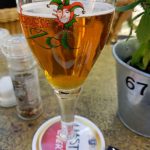
Brink/Specialty Beer Cafe The Witch (Bierencafe De Heks)
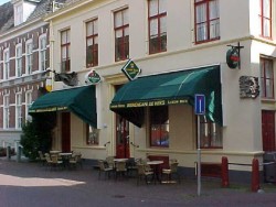
De Heks te Deventer
This part of the Brink, in the shadow of the Waag has lots of beautiful monuments too. One of those is Bierencafe De Heks (Specialty Beer Cafe The Witch). It boasts the most tapped draught beers of Deventer. A drunk witch on a broomstick has crashed herself against its outer wall. I’d advise you to take a cold beer or two or three… or…hips… and sit on the terrace, admiring the monuments around you.

Website: www.deheks.nl
![]() After leavin the Heks, turn left and walk straight into the Polstraat.
After leavin the Heks, turn left and walk straight into the Polstraat.
Polstraat
 It’s not completely clear where the name Polstraat originated from, but the best guess is that it originated from Poelstraat (meaning Pool Street in English). We’re now entering the oldest part of the city of Deventer. The Brink is very low in altitude and the streets running from the Brink all climb up towards a sand dune. On the other side of the Brink we visited the sand dune of the Bergkwartier, now we visit the third Sand dune, the one where Deventer started. The Polstraat is packed with beautiful monuments of which one of the best is seen almost immediately after leaving the Brink on your left.
 Halfway at the corner with the Bursestraat (right), we see a book sculpture in the wall corner. The buildings in the Polstraat behind this book were the location of the first offices of Kluwer book publishers.
This is also the top of the dune. Even when the River IJssel is flooding, this part never did, not even its cellars.
About those cellars. It is told in very old texts from the Museum The Waag, that they were haunted.
Follow the Polstraat towards its end, but look for a narrow arched gate and alley on the left. Turn left.
![]() Follow the Polstraat towards its end, but look for a narrow arched gate and alley on the left. Turn left into the Manhuissteeg.
Follow the Polstraat towards its end, but look for a narrow arched gate and alley on the left. Turn left into the Manhuissteeg.
Manhuissteeg (Old men’s alley)
This one of the many narrow alleys in town. It leads towards a street named Achter de muren Duimpoort.
It is named after the old men’s house that was located here between 1473 and 1737.
Where the Manhuisteeg connects to Achter de muren Duimpoort is a nice view point where you have a great view across the IJssel river.
![]() At the end of the Manhuissteeg, turn right into Achter de muren Duimpoort.
At the end of the Manhuissteeg, turn right into Achter de muren Duimpoort.
Achter de muren Duimpoort
This is another street walking just behind the city walls. Some of these walls are now part of buildings facing the river IJssel.
![]() Proceed towards the end of the street Achter de muren Duimpoort where the Duimpoort was located.
Proceed towards the end of the street Achter de muren Duimpoort where the Duimpoort was located.
Duimpoort
Duimpoort – Former Deventer city gate, possibly named after the 14th century Deventer family Ten Dune.
The Duimpoort (also called Duinpoort) is a former city gate of the city of Deventer. Like many other city gates of Deventer, the Duimpoort consisted of both an inner and an outer gate. According to the city secretary Gerhard Dumbar, the gate was named after the opposite “rabbit gardens” that were demolished in the 15th century. The Duimpoort was to be renewed in 1626. Between 1832 and 1859 the gate was demolished in different phases. The streets Duimpoort and Achter de Muren-Duimpoort refer to the location of the former gate.
![]() Go right and enter the Grote Kerkhof (Former cemetery at the Lebuïnus Church/In English: Large Cemetry) one of the city centers largest squares. Walk around this square and enjoy the many splendid monuments that can be found here. Return afterwards to the Duimpoort.
Go right and enter the Grote Kerkhof (Former cemetery at the Lebuïnus Church/In English: Large Cemetry) one of the city centers largest squares. Walk around this square and enjoy the many splendid monuments that can be found here. Return afterwards to the Duimpoort.
Grote Kerkhof
You could walk around counterclockwise and specifically notice the following monuments:
Introduction: 1st it is important to undestand that the area your now entering, is that of the old Kapittel (Area where the Bisshop’s and their entourage lived, prayed and learned and ruled over Deventer and over the lands owned by the Bisshop). This area was a substantial part of the historic inner city and it stretched from the Grote Kerkhof to the Broederenkerk (Church of the Brethren).
Latin School
The decisive factor for the city was the development of the long-established collegiate school into a highly regarded Latin city school under the influence of the Brothers of the Common Life. Thomas a Kempis enjoyed his basic training there at the end of the 14th century. At the end of the 15th century, from 1483 to 1493, the school under the leadership of the rector Alexander Hegius would become one of the most important intellectual centers of the Northern Netherlands. Hegius introduced Greek as a profession, unique for that time. The still young Desiderius Erasmus therefore came to Deventer for a short period. From his writings it is known that he attended in Deventer a lecture by the important early humanist and theologian / philosopher Rudolf Agricola (1443? 4-1485). He was probably invited by his friend and former pupil Hegius. The Latin School in Deventer is called the ‘cradle of humanism’.
City Hall
This ensemble of ancient and modern buildings is the City Hall, seat of the Deventer City Counsel. It is worth to visit the backyard too.
Lange Bisschopstraat and Grote Poot
At the far end of the Grote Kerkhof, you’ll find the entrances to the Kleine Poot (left) Grote Poot (Right) and Lange Bisschopstraat (straight forward). De Lange Bisschopstraat (Long Bisshopstreet (not referring to a long Bisshop but a long street ;-)) derives its name from the period when 3 Bisshops had their ruling seat in Deventer. Nowadays it is the main shopping street in Deventer.
Liberty Statue
Across the City Hall is a statue commenmorating the victims of the 2nd World War.
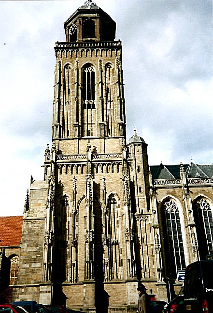
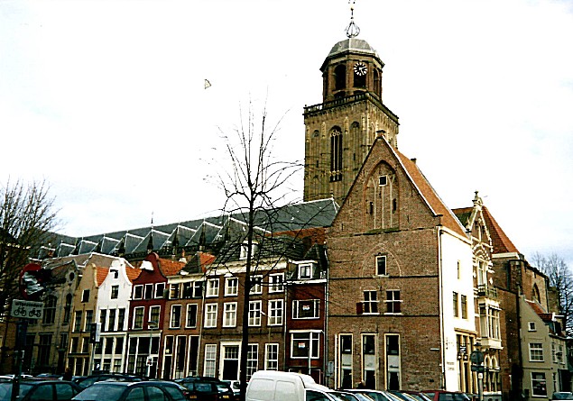
Grote of Lebuinus kerk
The main monument of Deventer is the Grote of Lebuinuskerk (Great or Laefwin Church), named after the 1st bisshop ever to visit Deventer and christen its citizens. He also built a small wooden church on the spot where we now find this humongous church.
Church Tower
In Spring and Summer it is possible to climb up the Church Tower. It is a steep and narrow climb but very much worth doing so. The views over town and river are excellent!
 The tower of the gothic Lebuinus Church was for a long time in its existence much shorter that it is now, as this maquette detail shows:

Maria Kerk
Left of the Lebuinuskerk is the much older Mariakerk, which is now home to Restaurant Het Arsenaal. This church has no roof but if you walk through the gate you can see the remains of the old church walls and windows.
Return to the Duimpoort.
![]() Standing at the Duimpoort facing the Lebuinuskerk, turn left and keep the buildings left near. In front of you is Waterstraat, a street going behind the buildings of the Grote Kerkhof. Follow Waterstreet to its end.
Standing at the Duimpoort facing the Lebuinuskerk, turn left and keep the buildings left near. In front of you is Waterstraat, a street going behind the buildings of the Grote Kerkhof. Follow Waterstreet to its end.
Waterstraat
Notice about halfway the spot to your left where there is an old commercial text printed on the wall above. The houses left are actually wider on this side than they are on the side facing the river IJssel. The reason for this is that in the Middleages, the amount of tax you had to pay for such a house was calculated, based upon how wide your house front was. Some houses have a trapezium floorplan and the short side of the trapezium is the front side.
![]() Stop at the end of Waterstraat and look left. This street towards the IJssel is the Vispoort.
Stop at the end of Waterstraat and look left. This street towards the IJssel is the Vispoort.
Vispoort
 The Vispoort is a former medieval city gate of the Dutch city of Deventer. Because a double city wall surrounded Deventer, there was both an indoor and an outdoor fish port. They were not in line with each other, after passing the outer gate a bend had to be made to pass through the inner gate. This made it difficult for enemy invaders. Outside the port, fish was brought in and traded at the IJsselkade. The Fish Gates were demolished in parts in the period from 1839 to 1873. The outer gate disappeared first in 1839 and was replaced by an iron gate. The Binnen-Vispoort was demolished in 1841, except for the two towers of the gate. The towers served as an observatory and were connected to each other by means of a wooden walkway. Eventually the towers of the Binnen-Vispoort were also demolished.
![]() Do not turn left but turn right instead. You’ve now reached the Nieuwe Markt (New Market).
Do not turn left but turn right instead. You’ve now reached the Nieuwe Markt (New Market).
Nieuwe Markt

The Nieuwe Markt is another of the many beautiful market squares used for trading goods in the heydays of the Hanze Union. The square has lots of monuments on 3 sides of the square. One square however is occupied by a rather ugly 70’s Schoolbuilding.
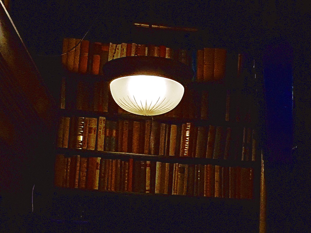
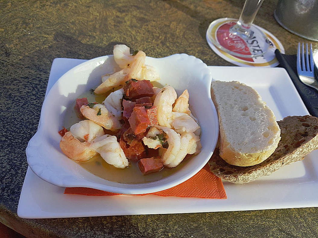
Grandcafe De Dikke van Dale***
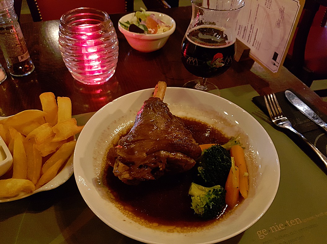
Near Waterstreet is a delightful Grandcafe named Grandcafe De Dikke van Dale. I’d advise you to visit this beautiful Grandcafe and eat and drink something before you walk further. The Grandcafe boasts a quite large terrace which is very sunny in the late afternoon. The interior is quite special. The name Dikke van Dale (in English something like the fat van Dale) is derived from the most famous dutch dictionary. It is a very thick or fat book and the 1st one was written by Johan Hendrik Van Dale, February 15, 1828 who was born in Belgium. The interior is decorated like a cosy library full of bookshelfs. They serve good, tasteful and sturdy food for a decent price. Also they have quite some specialty beers on tap.


Website:
www.dedikkevandale.nl*** In 2018, Grandcafe De Dikke van Dale closed permanently and was changed into St. Maxime where you can enjoy French style cuisine. Good alternative locations for lunch or breakfast are provided in the linked blogpost:


![]()
Turn your back to the entrance door of St. Maxime (former Grandcafe De Dikke van Dale) and walk straight ahead crossing the utmost left side of the Nieuwe Markt. Walk as much left as possible until you reach the Noordenbergstraat. Now your entering the Noordenbergkwartier again.
Noordenbergstraat
The Noordenbergstraat is one of the Noordenbergkwartier’s most beautiful streets. In the old days it ran from the Nieuwe Markt to the Noordenbergschild, but nowadays the street is divided into two parts, the other part being the Korte Noordenbergstraat (korte is short), which we already visited on our first visit to the Noordenbergkwartier. Enjoy the awesome monuments sprinkled over the whole length on both sides of this street.
![]() Proceed on the Noordenbergstraat and look about halfway for a narrow cobble stone paved alley with arches above keeping the walls of the buildings from collapsing. This is the Kranensteeg (Crane Alley).
Proceed on the Noordenbergstraat and look about halfway for a narrow cobble stone paved alley with arches above keeping the walls of the buildings from collapsing. This is the Kranensteeg (Crane Alley).
Kranensteeg
Alley that ended at the unloading crane on the IJssel riverbank. The old buildings designed in the Middleages or 16th centyry were not as sturdy as we can build them nowadays. The outer walls could bend to the outside and to prevent this as much as possible from happening, stone arches were put between building walls to support them. Look up and you’ll see a few of those arches.
![]() Look left at the end of the Kranensteeg for some remaining fragments of Deventer’s City Walls, but turn right into Achter de Muren Vispoort.
Look left at the end of the Kranensteeg for some remaining fragments of Deventer’s City Walls, but turn right into Achter de Muren Vispoort.
Achter de muren Vispoort
And this is the third and last part of the streets running immediately behind the old city walls.
![]() Walk to the end of Achter de muren Vispoort. Now you’ve reached the Muggeplein. Then turn right andwalk around this beautiful small square which has become the Noordenberg’s center.
Walk to the end of Achter de muren Vispoort. Now you’ve reached the Muggeplein. Then turn right andwalk around this beautiful small square which has become the Noordenberg’s center.
Muggeplein
This small cozy square with a beautiful tree in its center, is the center of the yearly Pinksterfeesten (Pentecost national holiday). There are many monuments to observe.
Fermerie
This beautiful building was built in 1638 as a hospital by Henrick Losscher and Johan Jordens, but is best known as the community center of the Noordenberg quarter. A stone plaque commemorates its founders.
![]() Leave the Muggeplein at the Noordenbergstraat in the opposite direction form whence you came.
Leave the Muggeplein at the Noordenbergstraat in the opposite direction form whence you came.
Noordenbergstraat
In this part of the Noordenbergstraat to your left is the old Athenaeum Library.
Athenaeum Library
The Athenaeum Library, located at the Klooster is the oldest scientific library in the Netherlands with a large and important collection of old manuscripts and books of, among other things, the movement of the Modern Devotion.
In 1560, the Deventer city council bought 44 books from the late Jan Willemszoon harbor porpoise (parish priest Phoconius) for 102.5 gold guilders. The city government immediately ordered to make ‘voir dese Stadtsboecken’ a cupboard. The city library of Deventer was a fact. In 1630 the Athenaeum Illustre was established. This regional university college remained in existence until 1878. In 1820 the books of the University of Harderwijk were purchased.
Worth mentioning are the Van Vloten collection, the Louis Couperus collection by W.M.S. Pitlo-van Rooijen (donated in 1984) and the J.H. Leopold collection from Gerard Burger, chairman of the Humanistisch Verbond, Deventer (donated in 2009). The city library was also a library for the Athenaeum. This explains the name Athenaeum library.
In 2010, the 450th anniversary was celebrated, on the occasion of which an exhibition with masterpieces was organized. Just then a manuscript by Louis Couperus from private ownership (namely from collector Pieter Berend Oudemans, 1960-2005), Elyata, went over to this collection. The library incorrectly suggested in the accompanying press release that this was the last manuscript of Couperus in private possession.
The collection of the Athenaeum Library contains a large number of special manuscripts, atlases and books from the early days of printing. A number of these can be browsed through the masterpieces collection on the website of the library.
Well-known directors of the Athenaeum library in the 20th century included Bert van ‘t Hoff, Anton Koch and J.C. Bedaux.
![]() Proceed through the Noordenbergstraat and turn left onto the Klooster. We’ve now arrived at the jewel of the Noordenbergkwartier.
Proceed through the Noordenbergstraat and turn left onto the Klooster. We’ve now arrived at the jewel of the Noordenbergkwartier.
Klooster
Klooster is Dutch for Monastery. The main entrance to the Athenaeum Library is to the left immediately after you entered the Klooster. To the right is an old red mailbox. Behind and to the right are beautiful monuments like The Hof van Holland and the Sajetbaal.
![]() Proceed following the Klooster past the Athenaeum Library on the left.
Proceed following the Klooster past the Athenaeum Library on the left.
Tuinfeest/Garden Party
On the right is a little square between the buildings, which is every year used as the central area for Poetry Festival Het Tuinfeest (The Garden Party). Around the Klooster in this part of the Noordenbergkwartier are numerous beautiful gardens in which in summer on the saturday before the 1st sunday of August (when the Deventer Boekenmarkt is held), are used as backdrops for poets and musicians attending the festival.
Website: https://www.theaterbouwkunde.nl/theater/het-tuinfeest/
City Archives
 On the other side of the small square on the right side of the Klooster are the City Archives.
Since the Middle Ages, the archive has not only preserved the written representation of the work of the municipal administration, but also the archives of many Deventer families, institutions, organizations, churches and businesses. It not only forms the basis for good administration of the municipality, but is also a source of first-hand knowledge of the history of the city and region.
In 1999 the organizations of the City Archives and the Athenaeum Library were merged. In the completely restored Klooster 12 building, new integrated reception rooms and study rooms for archives and library visitors came in 2003. The Athenaeum Library is one of sixteen public libraries in the Netherlands under the name Plusbibliotheek with a scientific support function.
![]()
Proceed following the Klooster past the City Archives on the right. Go right after passing the archives on to a terrace (where you can eat or drink deliciously, especially the wines are recommended) and proceed through a large metal gate into the beautiful Monastery Gardens.
Monastery Gardens


 Just walk a bit through these wonderful gardens (specially when in bloom. Enjoy the art and the view over the garden walls towards the surrounding city buildings. Even the Lebuinus Tower is visible from here. It is a small peaceful oasis in the center of the bustling town and it probably was that too when it was still used by monks.

![]()
 Leave the Monastery Garden through the entrance gate. Cross the terrace and turn right passed Theatercafe Bouwkunde on your left in the pink building.

Theatercafe Bouwkunde
 The Tuinfeest festival is organized by Theatercafe Bouwkunde (Teatre Cafe Bouwkunde (Architecture)). It is a low budget teatre for smaller productions on the top floor and a restaurant on the lower floor with a large terrace outside.
![]() Proceed passed the Theatercafe Bouwkunde and turn right for a few metres into the Papenstraat.
Proceed passed the Theatercafe Bouwkunde and turn right for a few metres into the Papenstraat.
Website: https://www.theaterbouwkunde.nl/
Papenstraat
On the left side after a few metres you’ll find the monumental Jordenshuis (Jordens House).
Jordenshuis
In 1740 Adriaen Sloet and his wife Frederika Grevink commissioned a new facade for three adjacent buildings in the Papenstraat (now no. 26). (At the back of the building you can clearly see that it is actually three buildings). The façades that were there were replaced by a single gable, which was terminated over the entire width by a continuous cornice. The six shell-shaped consoles (supporting stones) that are directly under the cornice are executed in the typical rococo style of that era.
The house was only named after 1806 the name Jordenshuis, named after the Jordens family, who became owner until 1930. Many members of this family had studied law, and they also had their office of notary or other legal office in this building. Moreover, this prominent family from 1646 to 1787 was continuously represented in the urban government. The Jordenshof (a small courtyard, in another part of the city center which you’ll visit in part 4 of this walk was also owned by the Jordens family. The garden behind the Jordenshuis is every summer part of the Tuinfeest, and fubnctions as a backdrop for poets reading poetry aloud.
![]() Turn around and walk back to the Klooster, but do not enter it to the left, but turn right and proceed into the Tibbensteeg and cross a small alley. To the left is the Bruijnsteeg and to the right the Halvesteeg.
Turn around and walk back to the Klooster, but do not enter it to the left, but turn right and proceed into the Tibbensteeg and cross a small alley. To the left is the Bruijnsteeg and to the right the Halvesteeg.
Halvesteeg
Just look into the Halvesteeg which has entrances to two other gardens, but these are privately own and not accessible except during the Tuinfeest. Anuyway, it is still a very photogenic view to just look into the Halvesteeg.
![]() Cross the two alleys into an alley straigth forward named the Tibbesteeg.
Cross the two alleys into an alley straigth forward named the Tibbesteeg.
Tibbesteeg
The large dark building to the right is the old monastery hospital. Halfway the Tibbesteeg is to the right an entrance to the backyard terrace of the Gildehotel (Guild Hotel) and there’s a little chapel in this backyard too. The hotel balcony/verande were once used to transport patients outside where they could enjoy the sun and the fresh air.
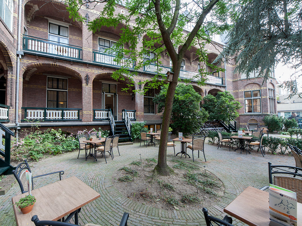
![]() Walk to the end of the Tibbesteeg and turn left for a few metres.
Walk to the end of the Tibbesteeg and turn left for a few metres.
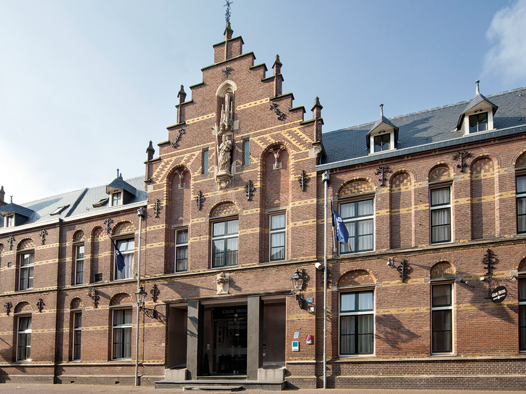
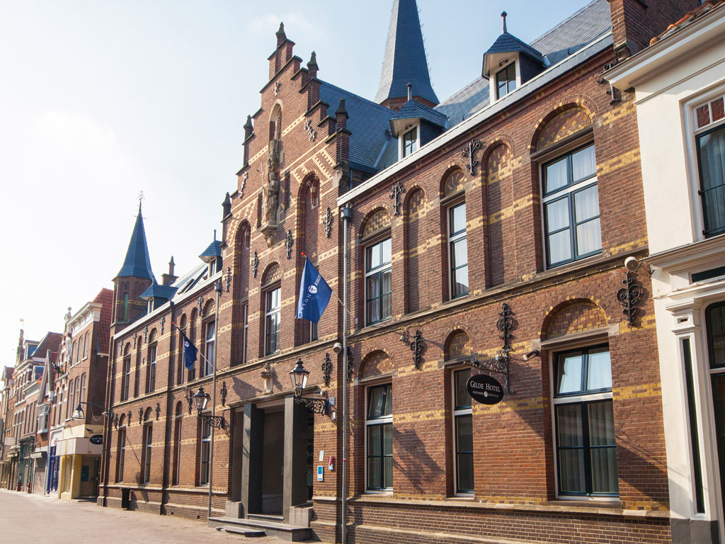
Nieuwstraat

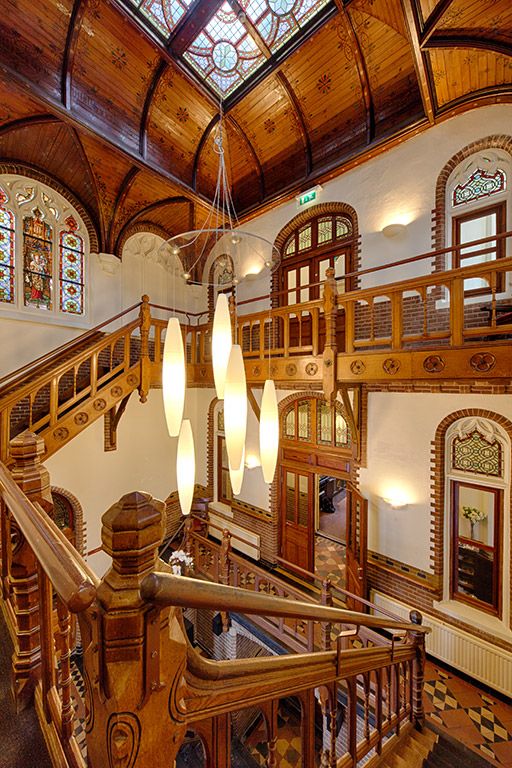
Gildehotel
You’re in front of the Gildehotel and its main entrance now. It is very worthwhile to step inside the main Hall and just look up for a brief while. If your staying the night in Deventer and wish to do so in a historic building than this hotel is the place to be.
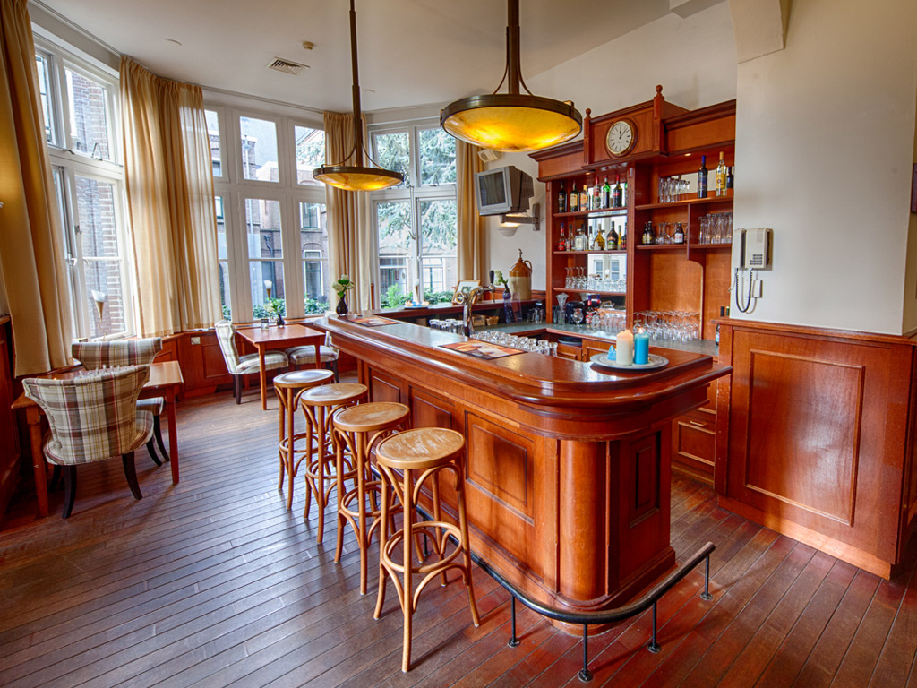
Standing in the Hall and looking up:
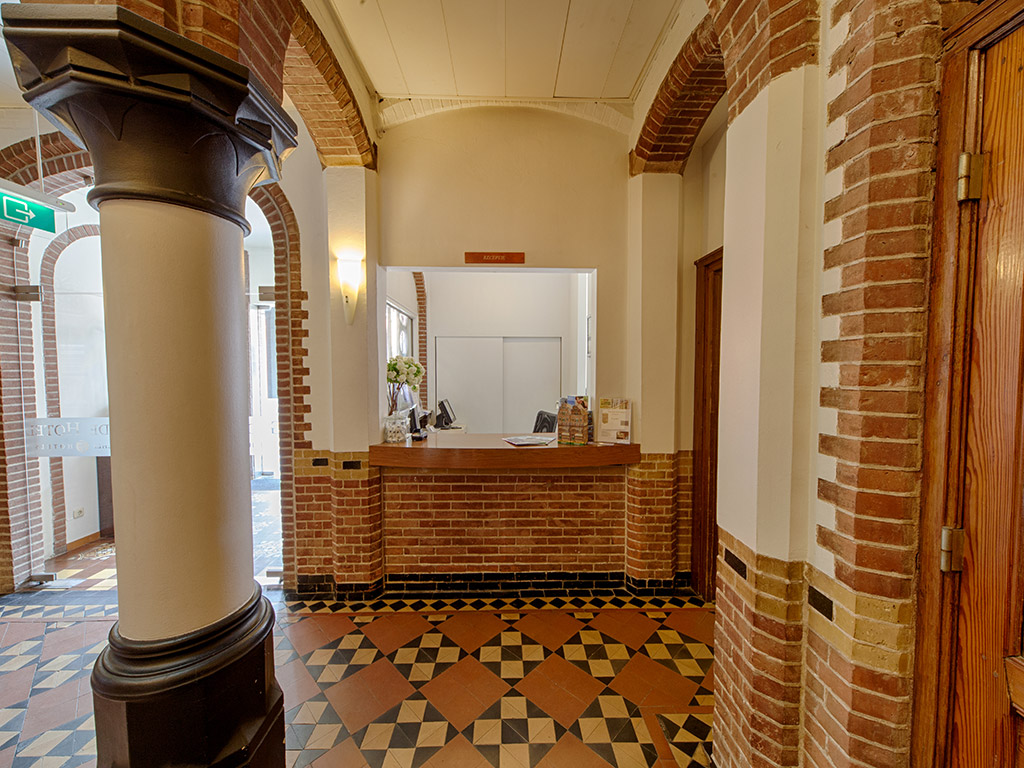
The reception area in the main hall:
Website: https://www.hotelgilde.nl/nl/
![]() Leave the hotel through the main entrance and go right. Follow the Nieuwstraat and look right for another smaller Hotel named Hotel De Leeuw.
Leave the hotel through the main entrance and go right. Follow the Nieuwstraat and look right for another smaller Hotel named Hotel De Leeuw.
Hotel de Leeuw
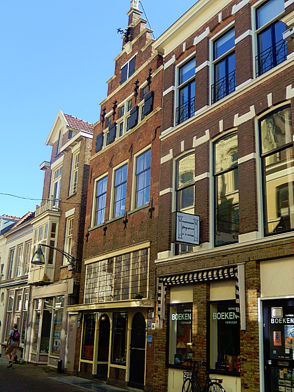

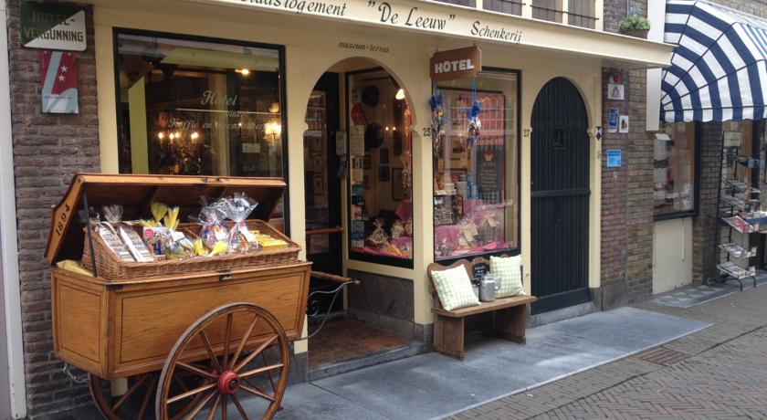
Entering Hotel De Leeuw is like walking into Hogsmeades Honeydukes, except: This is for real!!!
Website: http://mobile.hoteldeleeuw.nl/
![]()
Leave the Hotel de Leeuw through the front entrance. Turn right and walk towards the end of the Nieuwstraat. Now turn right and walk over the right sidewalk. This ia another square used inthe Hanseatic period for trade. You’re now walking on the Stromarkt.
Stromarkt
This is another square used in the Hanseatic period for trade. Stromarkt means Straw Market. On the other side of the road to your left is a brand new building, with a large glass facade. It mirrors the buildings on your right of which some are awesome monuments.
![]()
Follow the sidewalk until you reach a narrow street named Graven. Keep going straight forward and proceed on Graven. Neglect a street from the right (Papenstraat), which you visited earlier.
Graven
Graven (meaning Digging/Dig) is on the north edge of the Kapttel area, the area where the Bisshop and his entourage lived. This area was built as a city in a city for the Bishop and his clergy and the plan was to dig (Dutch graven) a moat around this area. The street Graven would have been where the moat was going to be. The digging of the moat did start here, but was never finished. There was however a wall build around the area which can be seen in these photographs of a city maquette, which is exhibited in the oldest still inhabited stone house of the Netherlands at the Sandrasteeg. The city kept growing quickly when the 3 Bisshops lived here and afterwards when Deventer joined the Hanze trade union.
![]()
Go to the other end of Graven and immediately turn left on the Nieuwe Markt. Cross the Nieuwe Markt and keep the school building to your left. Enjoy the view of the monuments. Again turn left after crossing the Nieuwe Markt into the Hofstraat.
Hofstraat
Street on top of the former bishop’s court (court in Dutch is hof) near the Lebuïnus Church. The streetname clearly reminds us of the former presence of the Bisshops.
![]()
At the end of the Hofstraat is the Kleine Poot, to the right is the new entrance through glass doors to the Lebuinus church and just before the entrance a small beautiful tine cobblestone paved space and some trees. But don’t go right but go left.
Kleine Poot
Botermarkt/Butter Market
You’ll now walk underneath the roof of a Butter Market.
Because Deventer was a real trading city, there used to be many locations within the canals where markets were held. Street names still remind us of that. There is the New Market (fruit and vegetables), Stromarkt (hay and straw) and the Houtmarkt (wood). On the Kleine Poot was the butter market, of which the building still exists. In addition, large annual markets took place at the “Brink”. Markets arose outside the canals, such as the trade in cattle on the Beestenmarkt.
Nowadays there are several weekly markets in Deventer, both in the center and in the suburbs.
The building of the Buttermarket originally contained a central part and two wing parts, of which the right wing part is nowadays removed.
Nowadays there are several weekly markets in Deventer, both in the center and in the suburbs.
![]()
Proceed to the end of the Buttermarket and turn right crossing the street and entering a narrow alley. This is the Sandrasteeg. Proceed to description and map 4.
Deventer (the ultimate historic walk for history lovers in 4 parts) Part 4