Germany (1998): Karl Kaufmann Weg/Ville-Eifel-Weg; Hiking through the Vulkaneifel Nature Park
In 1998, The Wandelgek drove to Bonn (which had long been the capital of West Germany), but nowadays (since 1990) Berlin is the capital of re-united Germany. From here he wanted to start backpacking the Karl Kaufmann Weg, which was a long distance trail running from Brühl (very near Bonn) to Trier (an old Roman settlement), via the …
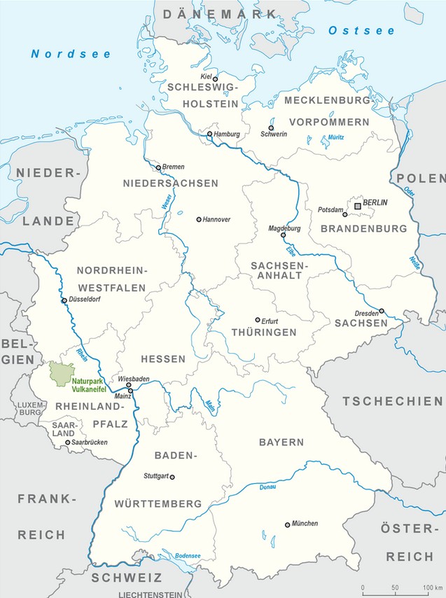
Volcanic Eifel Nature Park (Vulkaneifel Nature Park)
The Volcanic Eifel Nature Park (German: Naturpark Vulkaneifel) lies in the counties of Bernkastel-Wittlich, Cochem-Zell and Vulkaneifel in the German state of Rhineland-Palatinate. The nature park, which is in the Eifel mountains, and which is also a geopark, was inaugurated on 31 May 2010 and has an area of 1,068.24 km2. > Its sponsor is the Natur- und Geopark Vulkaneifel GmbH.
The Volcanic Eifel Nature Park incorporates large parts of the Volcanic Eifel and parts of the Volcanic West Eifel with its volcanoes that were still active until about 10,000 years ago numerous maars and lava streams as well as mineral springs and carbonic springs. Red sandstones and marine depositions date to an age of up to 400 million years ago. In addition, the region has a diverse cultural landscape as well as species-rich flora and fauna, extensive forests, mountains and valleys and numerous streams and rivers.
The highest mountain of the Volcanic Eifel Nature Park, which is bordered in the northwest and north by the High Fens – Eifel Nature Park, is the Ernstberg which, at 699.8 m above sea level (NHN), is the second highest peak in the Eifel after the Hohe Acht (746.9 m).
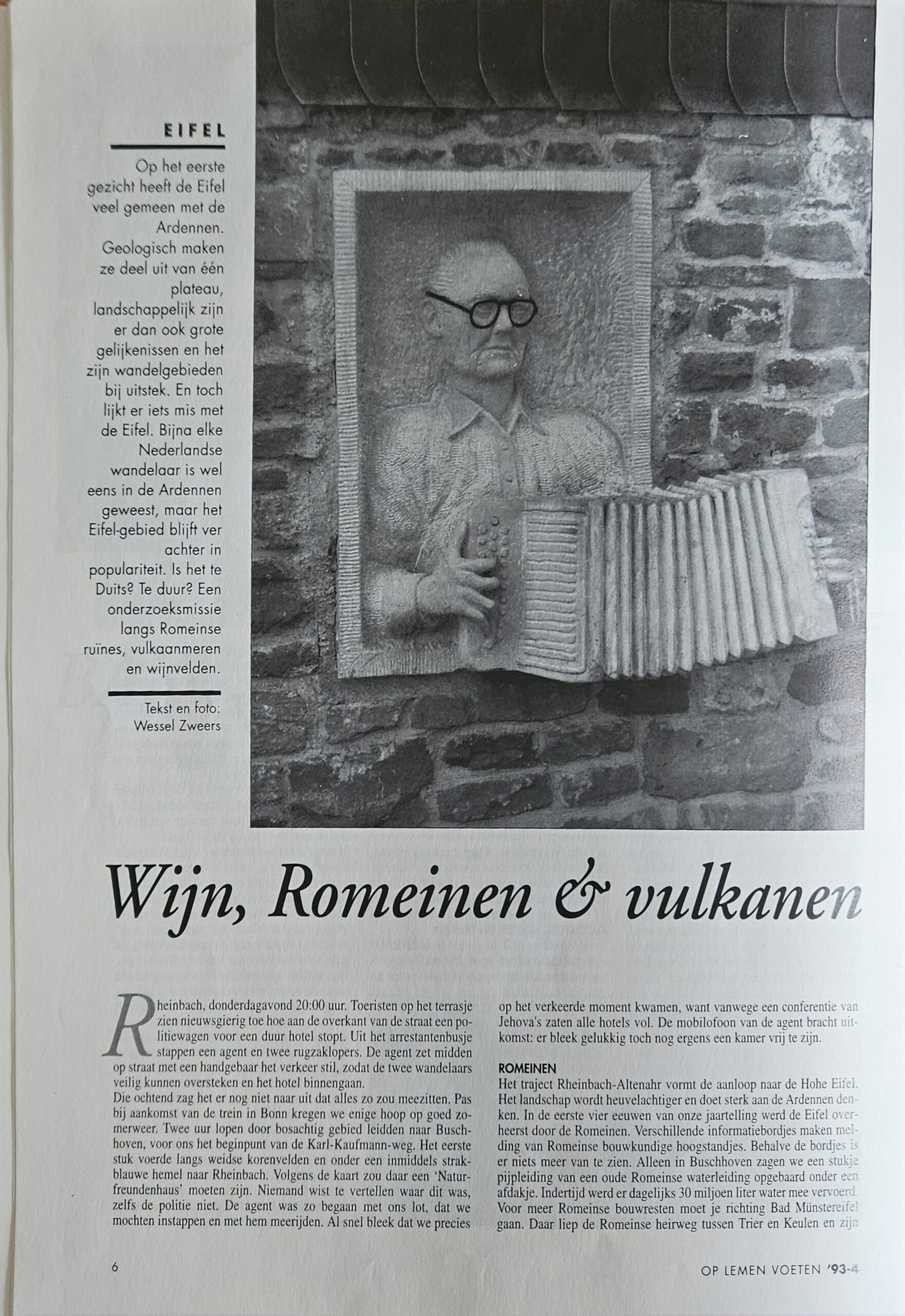
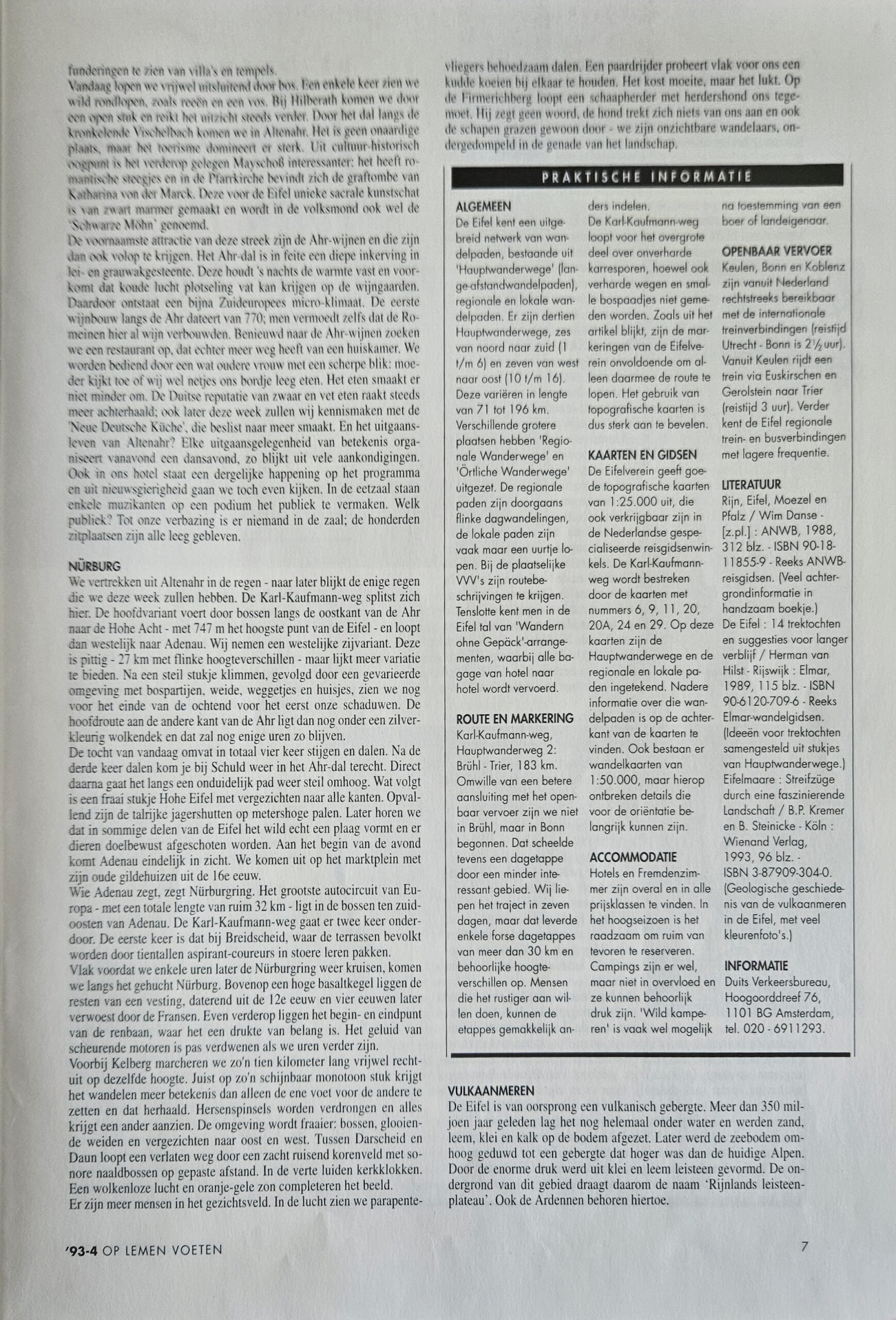
I found this walk while reading Op Lemen Voeten issue 4, year 1993. In this thematic issue about Germany I read an article titled Wijn, Romeinen en vulkanen (translated to English: Wine, Romans and Volcanoes. It was about the Karl Kauffman Weg. Together with a friend of mine who had pointed me to this article, we decided to go and hike this trail.
Bonn
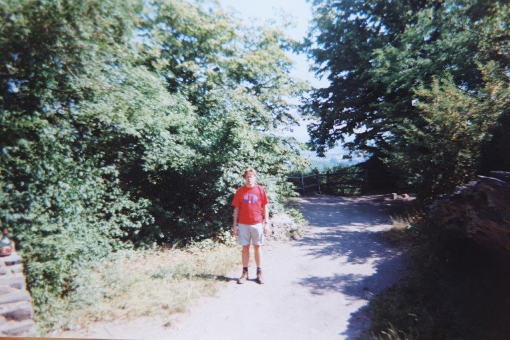
So one sunny morning we left The Netherlands and took the train to Bonn. There on a sunny cafe terrace, enjoying a large Paulaner Weizenbeer, we started our hike. The plan was not to walk the complete hike, but skip some of the more boring parts by bus and the start in Brühl, was one of the boring parts we would skip. We took a bus to a more rural village named Rheinbach, from where to start walking, both of us carrying a backpack with half of a tent tucked into it. In this blogpost you’ll find not the huge amount of photographs that I usually post, simply because (analog) photography back in 1998 was quite expensive. This is also why I waited so long with posting this blogpost, because this is mainly a photography blogpost site. However, I’m through my photo’s of my most recent travels and now have space to write and post some of the stuff I have been doing nearer to my home, meanwhile planning my next large travel adventure.
The Karl-Kaufmann-Weg (or nowadays: Ville-Eifel-Weg)
So what is the Karl-Kaufmann-Weg and who is or was Karl Kaufmann? Well there is quite something to tell about that:
Actually the Karl-Kaufmann-Weg is an old obsolete name (still active in 1998 wenn we hiked it, but renamed in … into the Ville-Eifel-Weg. Why was this done? Well that has a lot to do with WWII.
But first: Who was Karl Kaufmann?
Karl Leopold Kaufmann (15 November 1863 † 28 November 1944) was a German civil servant and writer.
Karl Kaufmann was born as the son of the mayor of Bonn, Leopold Kaufmann. After graduating from high school, he studied law at the University of Bonn. In 1886 he became a member of the Corps Saxonia Bonn. After completing his studies and obtaining his doctorate as Dr. jur. he entered the Prussian civil service and became a government councillor in the Trier government. In 1899 he was appointed district administrator of the district of Malmedy. In 1907 he moved to the district of Euskirchen as district administrator. He held the office until 1929.
During the occupation of the Ruhr, he was expelled in February 1923 as the first official of the Cologne administrative district with his family on charges of passive resistance and was not allowed to serve again until October 1924. From 1901 to 1907 he was a member of the provincial parliament of the Rhine Province. Karl Kaufmann was chairman of the Eifel Association from 1904 to 1938. He wrote some Eifel-related books. From 1894 he was married to Susanne Sophia Rautenstrauch. Kaufmann died in an air raid on Bonn.
So: Two main hiking trails were named after former chairmen, including the “Josef-Schramm-Weg” (between Kreuzau and Trier) and the “Karl-Kaufmann-Weg” (between Brühl and Trier). While the “Josef-Schramm-Weg” was already renamed “Felsenweg” in 2017 because of the NSDAP membership of the name bearer, the name “Karl-Kaufmann-Weg” was changed to “Ville-Eifel-Weg” in 2019 for, because of Kaufmann’s controversial role in the Third Reich’s Nazi past – not least under pressure from the anonymous hiking group Eifelgold.
Beneath is a map of the long distance trail:
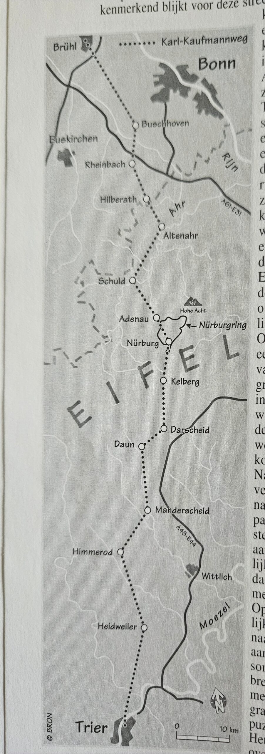
Karl Kaufmann Weg walking route …
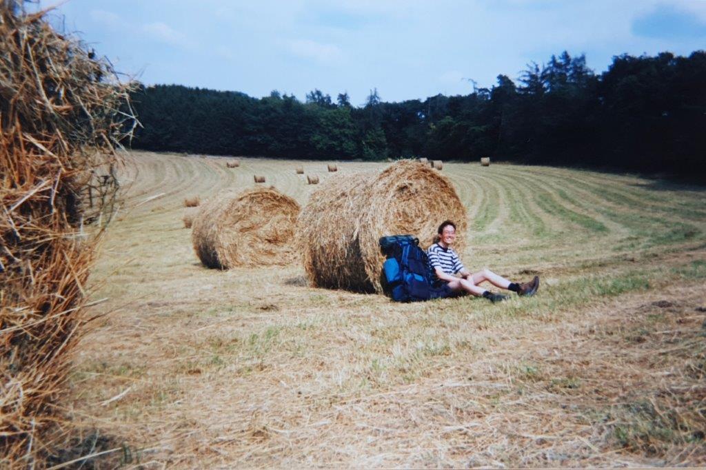
I remember the first part of the trail was agricultural, …
 …meanwhile entering the Vulkaneifel Nature Reserve where the landscape had changed into large forest areas.
Vulkaneifel Nature Park
 The Volcanic Eifel Nature Park (German: Naturpark Vulkaneifel) lies in the counties of Bernkastel-Wittlich, Cochem-Zell and Vulkaneifel in the German state of Rhineland-Palatinate. The nature park, which is in the Eifel mountains, and which is also a geopark, was inaugurated on 31 May 2010 and has an area of 1,068.24 km2. > Its sponsor is the Natur- und Geopark Vulkaneifel GmbH.
The Volcanic Eifel Nature Park incorporates large parts of the Volcanic Eifel and parts of the Volcanic West Eifel with its volcanoes that were still active until about 10,000 years ago numerous maars and lava streams as well as mineral springs and carbonic springs. Red sandstones and marine depositions date to an age of up to 400 million years ago. In addition, the region has a diverse cultural landscape as well as species-rich flora and fauna, extensive forests, mountains and valleys and numerous streams and rivers.
The highest mountain of the Volcanic Eifel Nature Park, which is bordered in the northwest and north by the High Fens – Eifel Nature Park, is the Ernstberg which, at 699.8 m above sea level, is the second highest peak in the Eifel after the Hohe Acht (746.9 m).
The village where we started walking was Rheinbach a beautiful half timber village and walking through agricultural land via Hilberath toward Altenahr in the very beautiful Ahr river vale, …
Altenahr
Altenahr is situated on the River Ahr, on the northeastern edge of the Ahr Hills part of the Eifel mountains, approximately 10 kilometres west of Bad Neuenahr-Ahrweiler and about 35 kilometres southwest of Bonn.
In Altenahr was a place where we got ourselves some fries to eat, but we had to eat rather fast because it started to get dark and we still had to find a place to set up our tent. So after this fast meal, we threw our backpacks over our shoulders and started a fast paced ascend of the steep hills surrounding Altenahr and that didn’t go to well at all. Halfway of the climb I started barfing out my meal, because you cannot get enough oxygen for your stomach to digest a meal and get enough oxygen to fast pace up a steep hill with a heavy backpack on your shoulders… Lesson learned!!! 😀
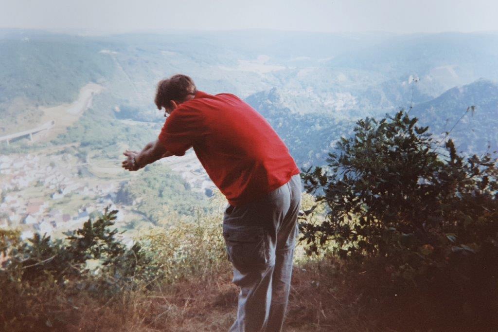
Completely emptied I arrived on the hill top, where it was already almost dark. There was a nice place to set up the tent though. Setting up the tent was priority one and we managed with the help of some flashlights. After a quick cup of tea, we quickly got in and fell asleep. Next morning after a night’s rest on a roaring empty stomach, The Wandelgek opened the tent and saw the amazing view over Altenahr…
Diving into our adventures …
After a warm cup of coffee, breaking up camp and repacking our backpacks, we walked through deep green forest toward beautiful Schuld …
and onward to Adenau.
Adenau
Adenau is a town in the High Eifel in Germany. It is known as the Johanniterstadt because the Order of Saint John was based there in the Middle Ages. The town’s coat of arms combines the black cross of the Electorate of Cologne with the lion of the lords of Nürburg. The northern loop of the Nürburgring lies just outside the town.
The Breidscheid section of Adenau was a separate municipality until 1952. The lords of Breidscheid are mentioned in the 13th century. The chapel of Breidscheid is dedicated to Saints Roch and Sebastian and was built in 1630 as a plague chapel.
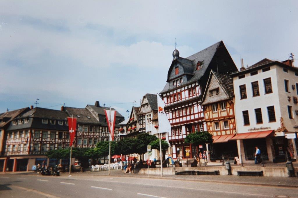
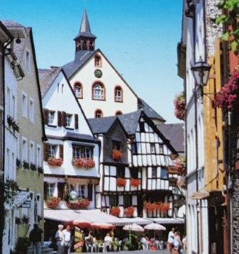
Beautiful half timber houses in Adenau’s marketplace. The highest house is from 1630.
Adenau is mentioned for the first time in 992, under the name Adenova. In 1162, Ulrich, Count of Are donated his manor to the Order of St. John (also called the Order of Malta). Adenau was the third oldest settlement of this order in Germany. The members of the order cared for paupers and pilgrims. Until 1518, the Komtur of the order also served as the parish priest.
In 1816 Adenau became the seat of an independent district. The District of Adenau was one of the poorest districts in Prussia. In 1927 the Nürburgring opened, built on the initiative of local magistrate Dr. Otto Creutz. In 1932 the district of Adenau was merged into the district of Ahrweiler.
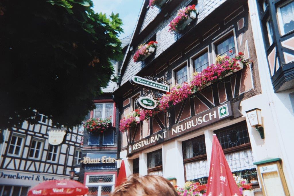
Somewhere between those beautiful halftimber houses we had a good breakfast and a cappuccino.
The next part of the hike led us passed the:
Hohe Acht
The Hohe Acht is the highest mountain (746.9 m above sea level) in the Eifel mountains of Germany. The Hohe Acht is located in the High Eifel east of Adenau. The mountain is a tertiary volcano, whose cone is composed of Lower Devonian rock and whose summit is made of basalt. The Hohe Acht is one of the volcanoes which gave their name to the Vulkaneifel. The walk however did not go over the Hohe Acht but instead went toward the famous:
Nürburgring
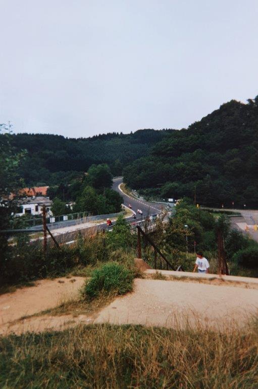
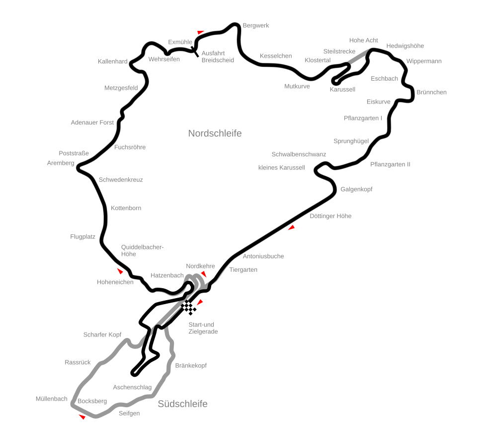
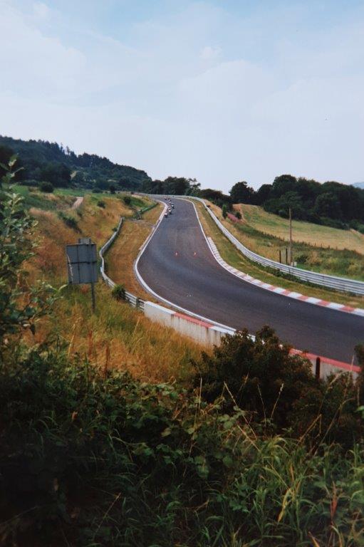
The Nürburgring is a 150,000-person capacity motorsports complex located in the town of Nürburg, Rhineland-Palatinate, Germany. It features a Grand Prix race track built in 1984, and a long Nordschleife configuration, built in the 1920s, around the village and medieval castle of Nürburg in the Eifel mountains. The north loop is 20.830 km (12.943 mi) long and contains more than 300 metres (1,000 feet) of elevation change from its lowest to highest points. Scottish racing driver Jackie Stewart nicknamed the track “the Green Hell“.
Originally, the track featured four configurations, namely the 28.265 km-long (17.563 mi) Gesamtstrecke, which in turn consisted of the then-22.835 km (14.189 mi) Nordschleife, and the 7.747 km (4.814 mi) Südschleife. There was also a 2.281 km (1.417 mi) warm-up loop called Zielschleife, or Betonschleife, around the pit area.
Between 1982 and 1983, the start–finish area was demolished to create a new GP-Strecke, which is now used for all major and international racing events. However, the shortened Nordschleife is still in use for racing, testing and public access.
Prior to World War II, the Nürburgring hosted 13 editions of the German Grand Prix from 1927 to 1939. In Formula One (F1), it has hosted 42 Grands Prix, including the German, European, Luxembourg, and – most recently – 2020 Eifel Grand Prix; Michael Schumacher achieved the most victories at the Nürburgring, winning on five occasions between 1995 and 2006. The 1976 German Grand Prix, held on the Nordschleife, was the last F1 race ever contested on a circuit of 10 or more kilometres (6.2 or more miles). As of 2025, the venue hosts several national GT events, including the Deutsche Tourenwagen Masters.
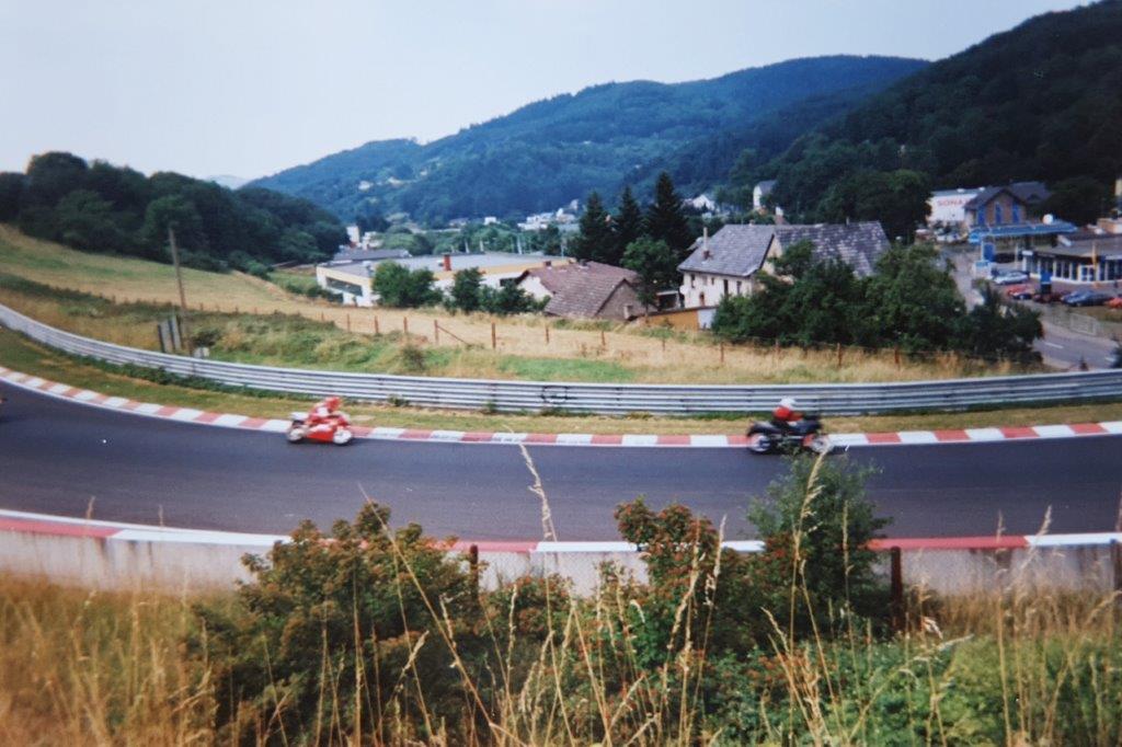
This was a great spot to see some adrenalin junkies on fast driving motorcycles …
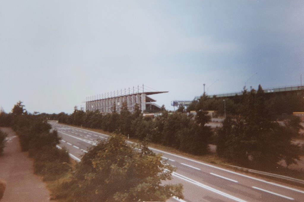
After having crossed the Nürburgring, the next part of the walk went through dark green forest via Kelberg, to Darscheid, and the Kürort (health resort) Daun.
Daun
In the center of Daun was a statue named Himmelsleiter. The statue depicts a small group of people climbing a ladder, often interpreted as a metaphor for discovery, adventure, and “rising above the ordinary world”—fitting the volcanic and geological themes of the region.
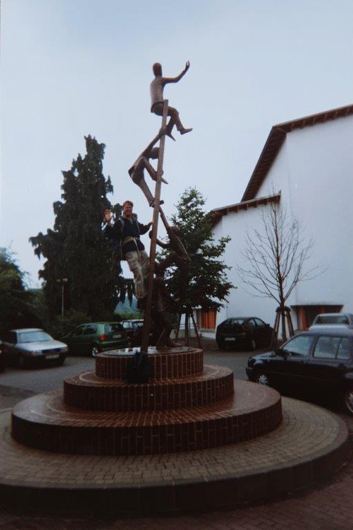
Still in search of more adventure …
The first settlement in the area came as early as the 7th century BC by which time the Celts had settled the fortified basalt mountain in Daun. The Romans, too, used this prominent hill in the Lieser valley as a watch post, as witnessed by Roman finds. The placename may have come from the Celtic-Roman word Dunum, meaning either “fence” or “fortified heights”, that is to say, a fort.
In the late 10th century, a castle complex belonging to the free Lords of Daun arose here. In 1075, Daun had its first documentary mention in a townsman named Adalbero de Duna.
In 1163, the free lords’ family died out. One of the family’s ministeriales, Richardus de Duna, took over his former Lord’s name and even the coat of arms with the Daun fretting. In 1337, Daun is mentioned for the first time as being a town. In 1346 came a grant of town rights along with market rights, and Daun became at the same time the location of a high court.
In 1712, the Electoral-Trier Amtshaus was built by the Elector of Trier and Archbishop Karl-Josef on the Burgberg (“Castle Mountain”). After a transitory occupation by the French beginning in 1794, the village passed in 1815 to the Kingdom of Prussia. In 1817, Daun became seat of the district and an Amt mayoralty, and also at the same time a district administrator’s seat. Since 1947, it has been part of the then newly founded state of Rhineland-Palatinate. Beginning in 1951, Daun could once more call itself a town.
On 15 May 1895, Daun was linked to the German railway network with the Eifelquerbahn (Cross Eifel Railway). On 1 December 1909, a further railway line, the Maare-Mosel-Bahn to Wittlich came into service. All public rail transport, however, ended in Daun more than a decade ago, although a two-hourly daytime service for tourists has been running in the summertime since 2005 on part of the Eifelquerbahn. The Maare-Mosel-Bahn, on the other hand, was torn up about a decade ago and has since become the Maare-Mosel-Radweg, a cycle path.
In 1965, Daun became a garrison town, housing at the Heinrich Hertz Barracks, among others, two signal corps units and one signals intelligence unit.
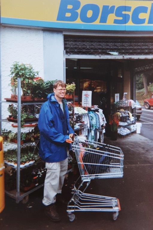
There was a supermarkt in central Daun, were we could replenish our food stores …
 There were two reasons to start thinking of a detour from our plan to follow the Karl Kaufmann Weg all the way to Trier.
- A change in weather conditions. It had gotten much more cloudy and rainy.
- More important even: The walk seemed to keep crossing through dense dark forest and a bit of change in landscape would be welcome.
- There was a rather cool possibility to deviate and find that change of landscape.
After leaving Daun, we arrived in Manderscheid and from here we could start our detour. Weather and landscape had not changed so we decided to spend the night near Wanderscheid, but deviate from our plans the next morning by taking a bus toward Wittlich and start restart walking from there to the Mosel river and the half timber village of Bernkastel-Kues.
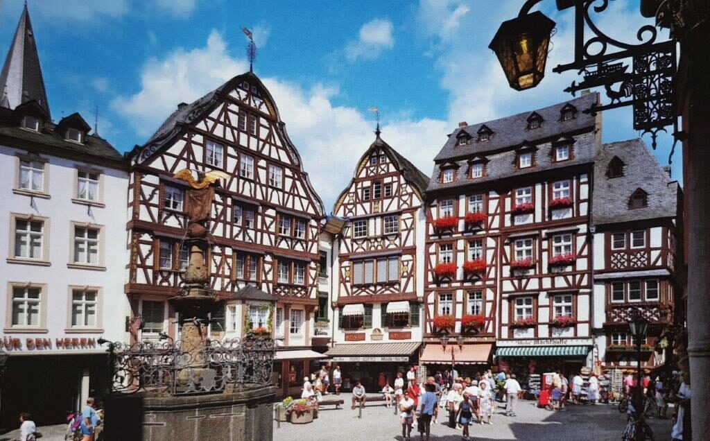
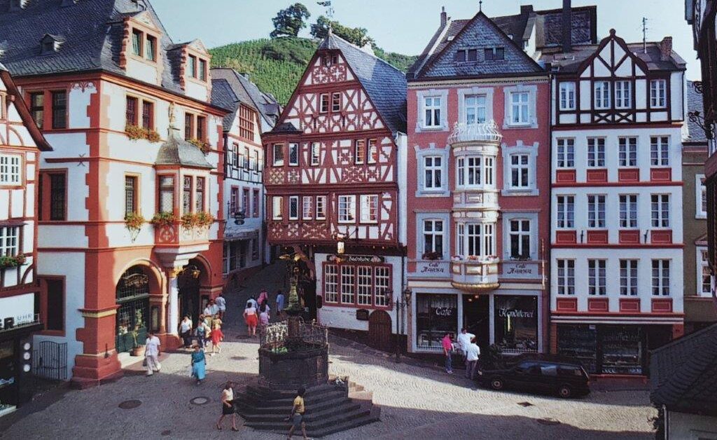
Next day around noon we arrived in beautiful and sunny Bernkastel-Kues.
Bernkastel-Kues
Bernkastel-Kues is a town on the Middle Mosel in the Bernkastel-Wittlich district in Rhineland-Palatinate, Germany. It is well-known for its winegrowing. The town is a state-recognized health resort (Erholungsort), seat of the Bernkastel-Kues and birthplace of one of the most famous German polymaths, the medieval churchman and philosopher Nikolaus von Kues (Cusanus).
Middle ages
In the first half of the 11th century, Bernkastel had its first documentary mention. At the turn of the 8th century, a geographer described a place called Princastellum. This is said to be evidence of a Roman castellum in the 4th century near today’s Landshut castle ruin. Pointing to this are, among other things, fittings and finds of ceramic and iron underneath the castle. The 12th-century form of the name, Beronis castellum, was a learned re-Latinization, which was related to Adalbero von Luxemburg. Work was begun on the third castle building under the lordship of Archbishop of Trier Heinrich II of Finstingen. On 29 May 1291, King Rudolph I of Germany granted Berrincastel town rights. The castle, Burg Landshut, which was built at that time, was given this name only in the 16th century. In 1332, the town rights were reaffirmed by Emperor Louis the Bavarian’s Sammelprivileg (a kind of omnibus decree that dealt with many rights and privileges). Under the terms of the Golden Bull of 1356, Bohemond II became Elector. According to legend, he was brought back to health from a serious illness by a glass of wine, giving rise to the legend of the Bernkastler Doctor winery. In 1401, Nikolaus von Kues, also known by his Latinized name Nicolaus Cusanus, was born in Moselle shipowner Henne Cryfftz’s house, which is well preserved and can be visited. In 1451, the St.-Nikolaus-Hospital, a hospital for the poor, was built. In 1505, in an Electoral edict from Jakob II, the name Landshut for the archiepiscopal castle crops up for the first time. Emperor Maximilian I spent a night in Bernkastel in 1512 on the way to the Imperial Diet at Trier. The Plague raged in Bernkastel in 1627, and in Kues in 1641. In 1692, Castle Landshut fell victim to fire and since then it has been a ruin.
Modern history
From 1794 to 1814, Bernkastel was a cantonal chef-lieu under French rule. At the Congress of Vienna in 1815, Bernkastel and Kues were annexed to the Kingdom of Prussia. In 1821 Bernkastel became a district seat. In 1848, the Revolution came to Bernkastel as it had to many of the then politically disunited German lands: The black-red-gold flag was hoisted at the town hall and a militia was formed. The first road bridge between Bernkastel and Kues was built between 1872 and 1874, as was the first railway link in 1882 and 1883. In 1891, Bernkastel marked its 600-year jubilee as a town. The town in its current form came into being on 1 April 1905 through the merger of the town of Bernkastel with the winemaking village of Kues across the river. In 1926 there arose great unrest among winemakers along the Moselle, and the financial office in Bernkastel and the customs office in Kues were stormed. On Kristallnacht (9 November 1938), there were great riots against Jewish inhabitants, and the synagogue was destroyed. In 1946, the first democratic elections after the Second World War were held. Hans Weber became mayor. In 1970, Andel and Wehlen were amalgamated with the town. With administrative reform in Rhineland-Palatinate, the Verbandsgemeinde of Bernkastel-Kues was formed through the merger of the Ämter of Bernkastel-Land, Lieser, Mülheim, Zeltingen and the town of Bernkastel-Kues. In 1997, the Burgbergtunnel, a traffic bypass, had its festive opening. Bernkastel-Kues was the host town for the annual Intercamp Camporee for the year 2008. Scouting councils from the USA, Canada, the Czech Republic, Germany, France, and many other European countries attended the event on May 9–11. In 2000 began the partnership between Bernkastel-Kues and Karlovy Vary in the Czech Republic. In 2005, the town celebrated the centenary of the merger of Bernkastel and Kues, and the municipality became a “climatic health resort” (Heilklimatischer Kurort).
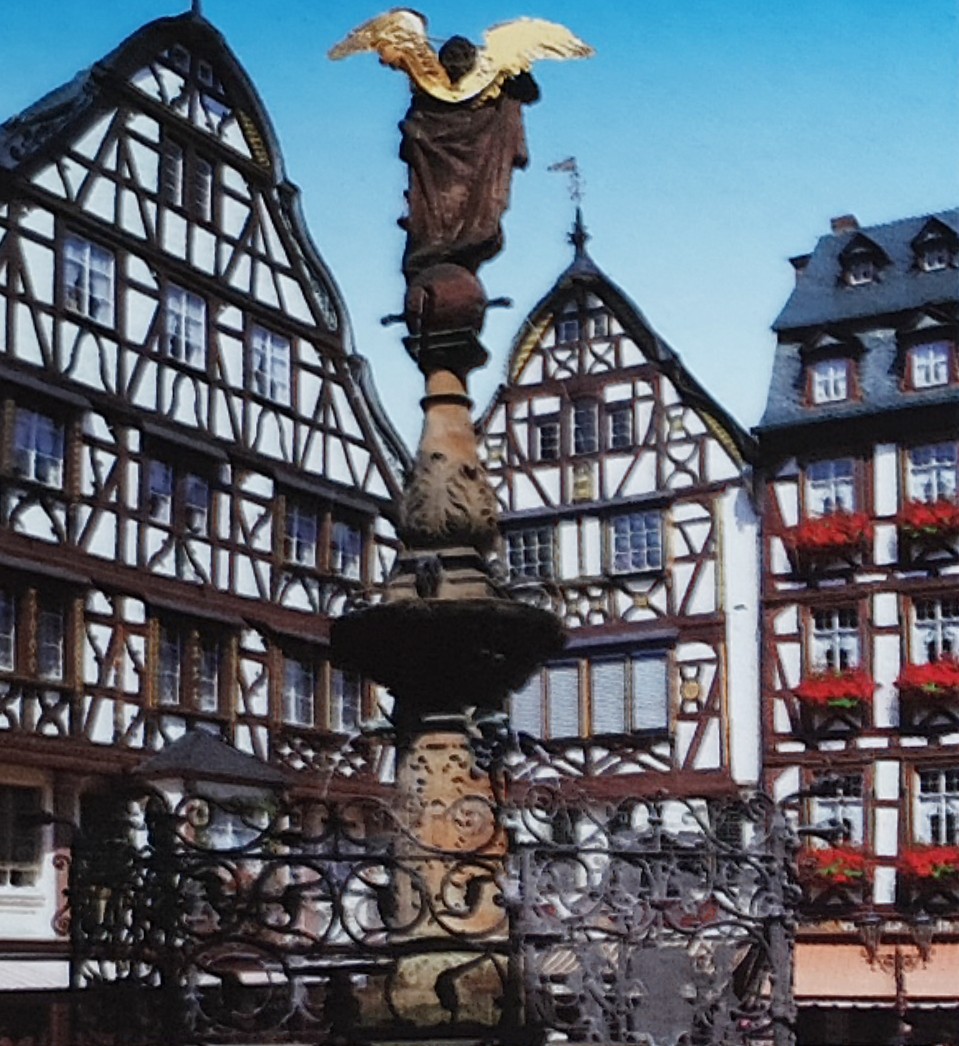
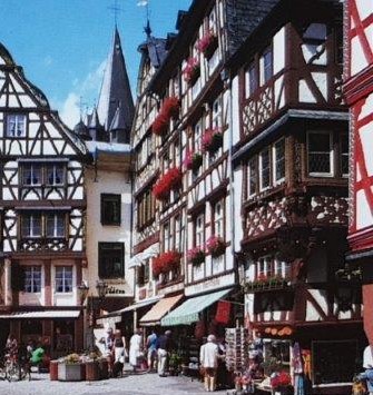
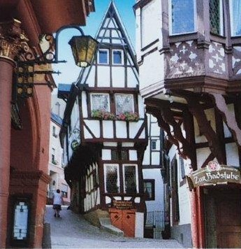 Worth seeing in Bernkastel is the mediaeval marketplace with its gabled timber-frame houses from the 17th century, foremost among which is the narrow Spitzhäuschen (“Pointed House”) from 1416. Around the St. Michaelsbrunnen (“Saint Michael’s Fountain”) from 1606 gathers a row of well-preserved buildings and also the Renaissance Town Hall from 1608. The Graach Gate is an often visited tourist attraction. Above the constituent community of Bernkastel lie the Castle Landshut ruins, a former summer residence of the Archbishops of Trier that was destroyed by fire on 8 January 1692. It today serves as a popular lookout point over the Moselle valley. Also worth seeing is the only town gate that is still standing, the Graacher Tor (“Graach Gate”).
 The town furthermore has several squares at its disposal; beyond the mediaeval marketplace are the Platz am Bärenbrunnen (“Square at the Bear’s Fountain”) and the Karlsbader Platz (“Karlovy Vary Square” – named after the partner town, which is called Karlsbad in German) opened in July 2005. The Doctorbrunnen (“Doctor Fountain”) depicts scenes of the old legend about a local wine, the famous “Bernkasteler Doctor”. Another well-known point of interest is the Late Gothic St. Nikolaus-Hospital (Cusanusstift), an Electoral complex of Nikolaus von Kues. The institution’s library has an outstanding scientific range of works. It is also well known for its chapel, where the heart of the great philosopher, cardinal and polymath Nikolaus von Kues (Cusanus) is buried. Near the outlying centre of Wehlen lies the former Machern Monastery in whose rooms are now found a winery, a house brewery and a restaurant.
Historically, the most important economic sector has been winegrowing. Within the Bernkastel area, vines are worked overwhelmingly in steep-slope vineyards in an area of 5,844 ha. There are still many wineries in Bernkastel-Kues today. Riesling is the customary grape variety, although smaller quantities of other varieties, such as Burgunder, Rivaner, Kerner and Dornfelder, are also grown.
Within town limits, the wine making appellations – Großlagen – Münzlay (Wehlen), Badstube (Bernkastel) and Kurfürstlay (Bernkastel, Kues and Andel) are represented by the following vineyards:
|
|
After a walk through we walked further up the Mosel river surrounded by hills full of vineyards (and meanwhile the sun was showing itself again), toward our end goal which was the Roman city of Trier, but of that town I will add a blogpost later. We would reprise but in a slightly different manner, this Eifel Walk in 2023. I’ll write about that walking event next, so stay tuned …