The Wandelgek has visited many beautiful mountains, but as so often it is not the destination but the road to get there which makes the journey worthwhile. So here is a blog about the mountain passes and high places that the Wandelgek visited/crossed or where he slept during a journey, to eventually reach those magnificent mountains. Ultimately some of these drive through places are much nicer than expected. Luxury is usually completely absent here, think of cold rooms, a can of drinking (after boiling it!) or washing water in the morning put at the door and toilets?; Oh well … In addition, the trips, hikes and treks are quite strenuous. Although it’s all well worth the effort! See for yourself …
Tibet
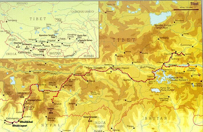
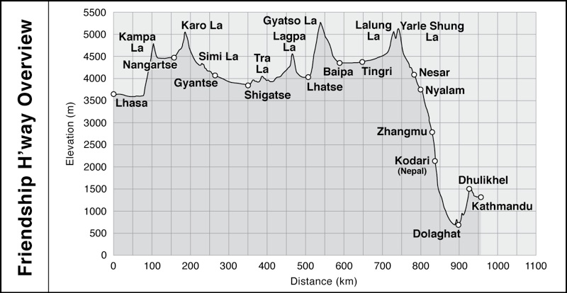
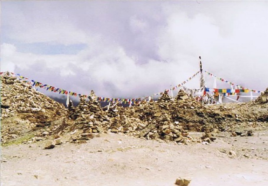
1. Gyatso La 5220 m. (Tibet)
This is the highest mountain pass on the Friendship Highway between Lhasa and Kathmandu. It’s windy and cold, but so beautiful that you’ll quickly forget about that.
On top of the highest pass of the Friendship Highway…
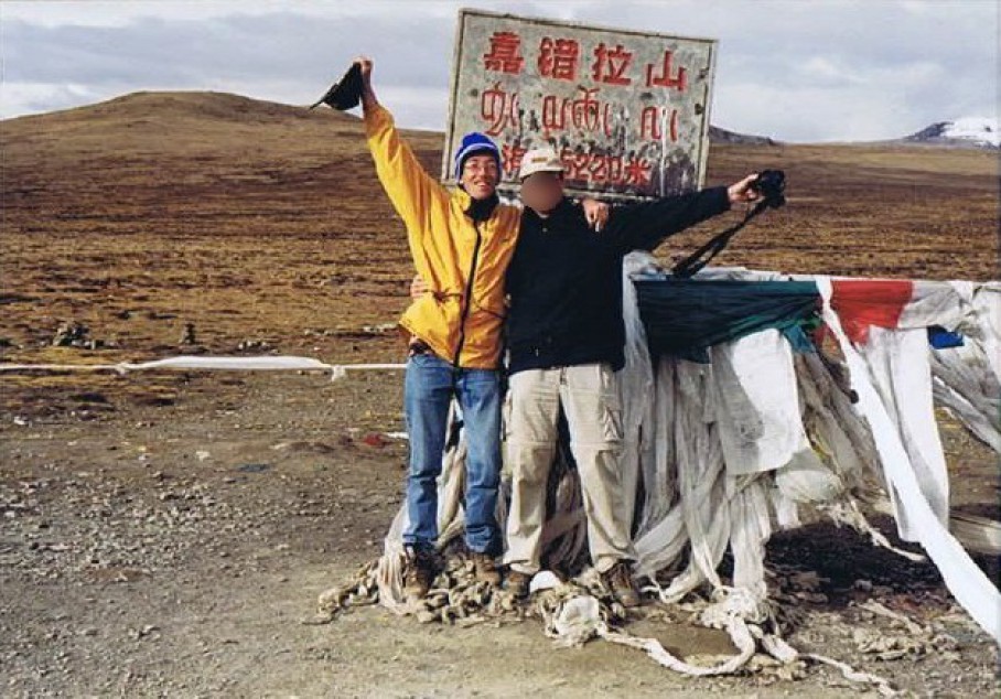
Wandelgek on the Gyatsu La mountain pass…
See: Travelling from Shigatse to the village and monastery of Sakya
2. Thang La 5200 m. (Tibet)
A set of very high mountain passes that precede the chillingly steep decline to Nepal.
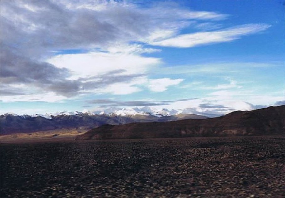
Thang La mountain pass…
The Thang La mountain pass…
See: From Tingri to the Himalayas
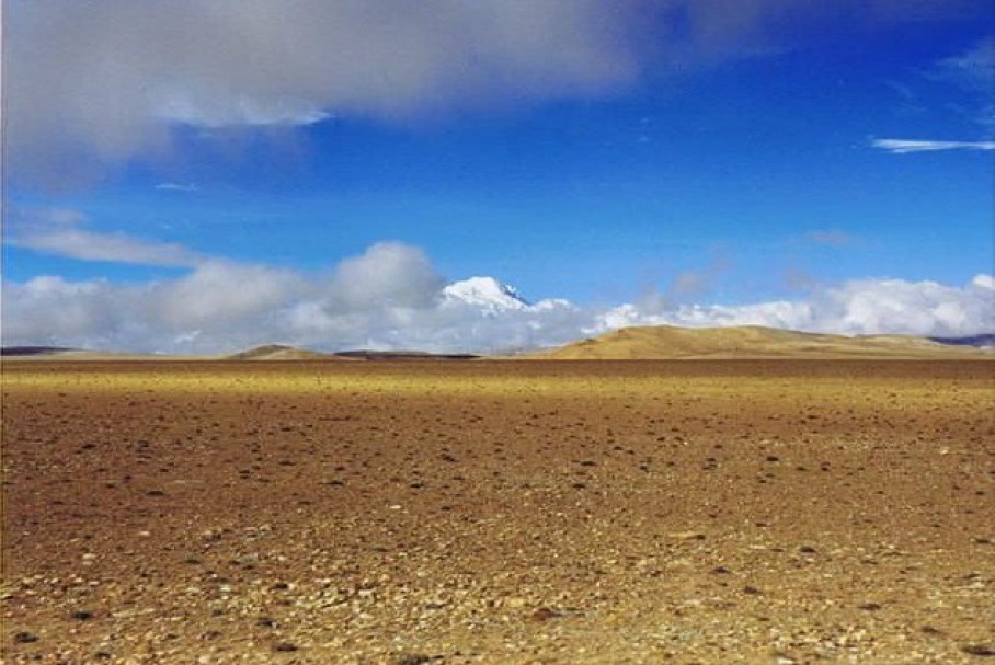
3. Everest Base Camp 5150 m. (Tibet)
Some say that the base camp is located at 5200 m, others argue a lot lower. 5150 m is an average. Except fog there was not much to see when I walked here. Quite impressive though …
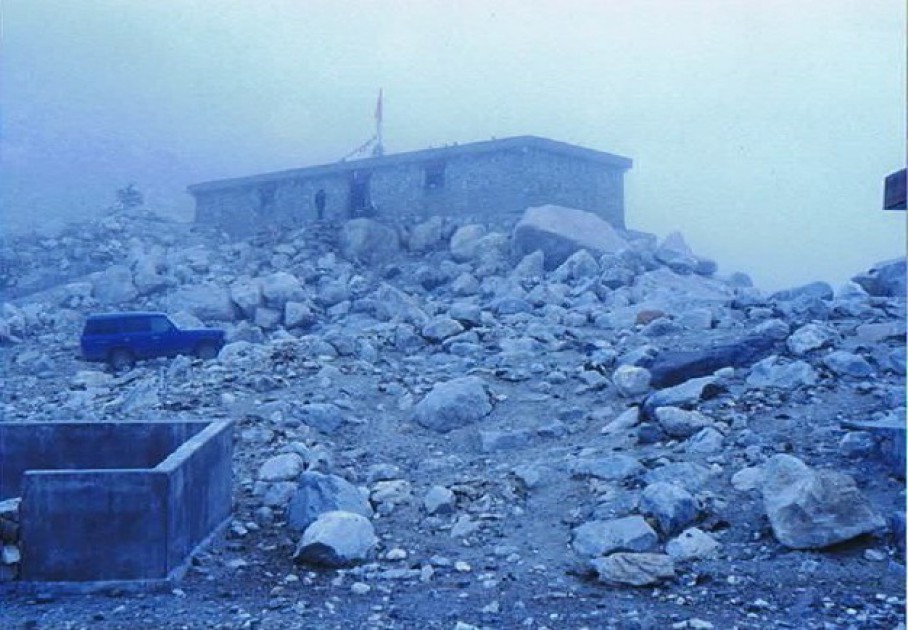
Thick, thick, thick mist at the weatherstation of the Everest basecamp…
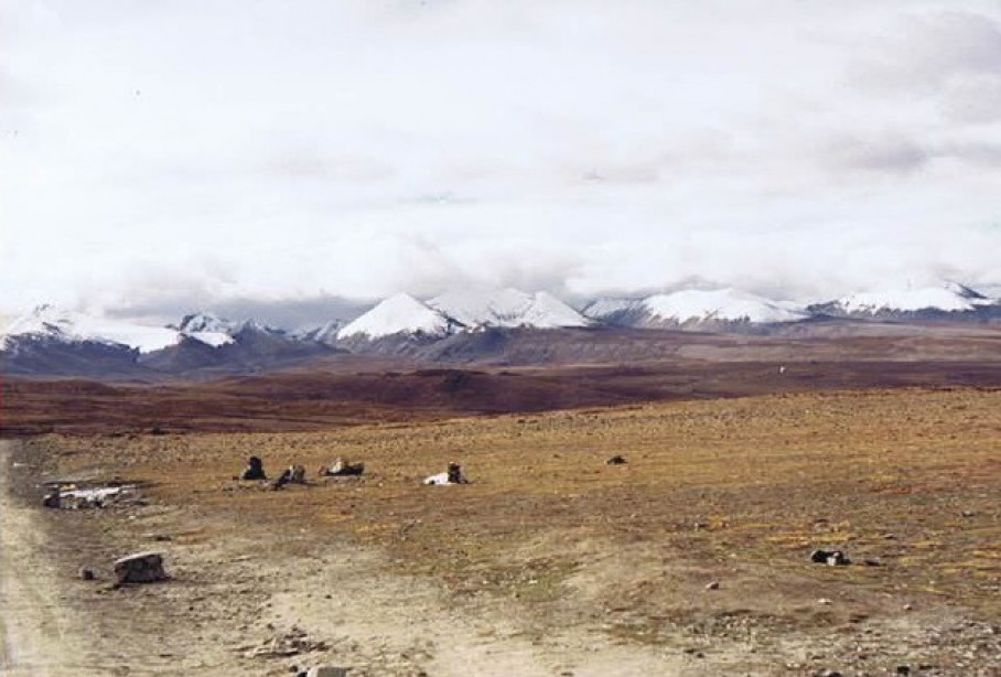
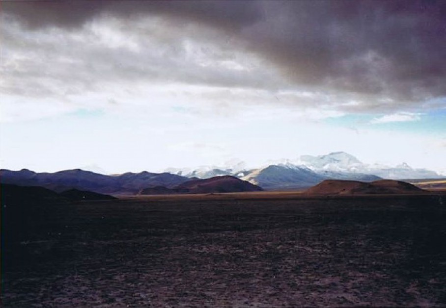
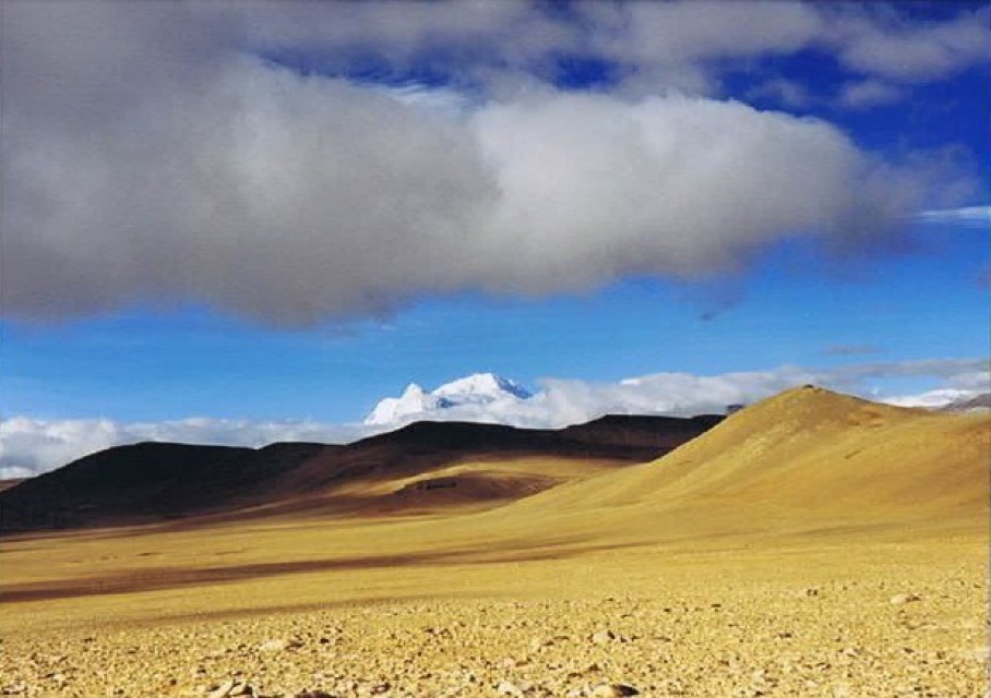
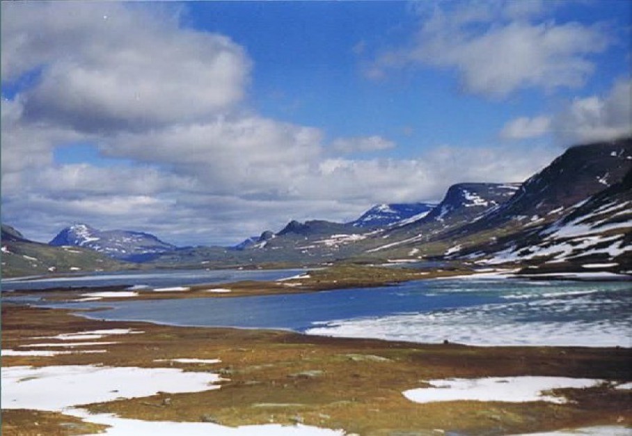
4. Pang La 5150 m. (Tibet)
The Pangla pass is not on the Friendship Highway but on a branch to the Everest base camp near Rongbuk.
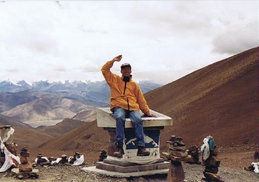
The Wandelgek on the Pang La mountain pass…
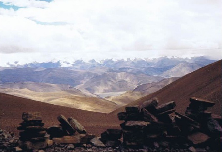
View over the Himalayas…
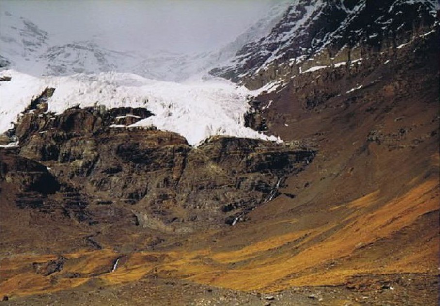
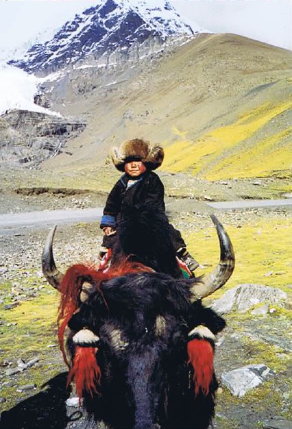
5. Rongbuk Monastery 5100 m. (Tibet)
Highest monastery in the world, but very hospitable for climbers, hikers, bikers, backpackers and other tourists.
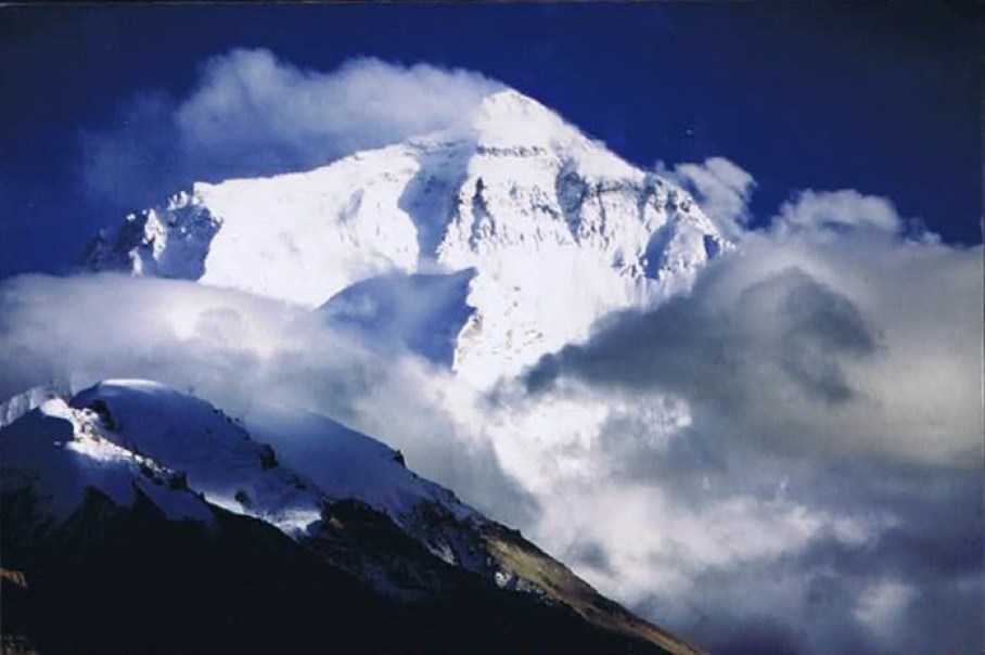
Mount Everest from Rongbuk…
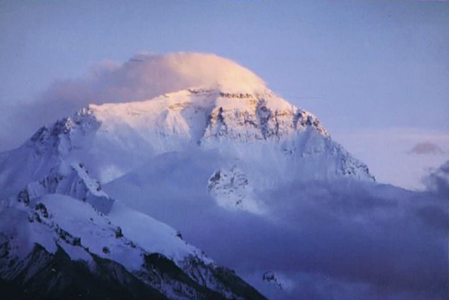
Sunset at Everest, seen from Rongbuk…
6. Lalung La 5050 m. (Tibet)
Another high pass before the descent is deployed to Nepal.
The Lalung La mountain pass: One of the most beautiful spots in this world just before the descent to Nepal…
Wonderful…
See: Travelling from Shigatse to the village and monastery of Sakya
7. Kharo La 5036 m. (Tibet)
On the Karo La mountain bergpass
Learned when young is done when old (Dutch expression literally translated)…
See: Yamdrok Tso
8. Kampa La 4794 m. (Tibet)
On top of the Kampa La pass
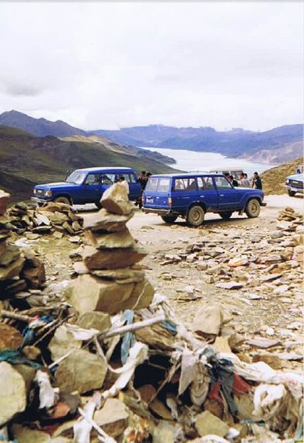
Yamdrok Tso seen from the Kampa La mountain pass…
See: Yamdrok Tso
9. Lagpa La 4500 m. (Tibet)
The Lagpa La is high but not above 5000 meters. The pass is situated before you reach Lhatse and lies close to a junction of the Friendhip Highway. A branch off runs to the Tibetan monastery and village of Sakya.
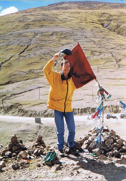
The Wandelgek on the Lagpa La mountain pass…
View from the Lagpa La…
See: Lagpa La
Kyrgyzstan
The high passes in Kyrgyzstan are also very impressive although they reach an average of 1500 to 2000 m lower than the ones in Tibet. Still these passes are over 3,000 m high!
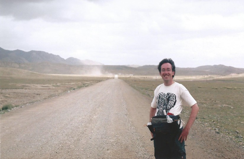
10. Torugart pas 3752 m. (China/Kyrgyzstan)
When the Wandelgek travelled on the Silk Road in 2004, he made a trip from Kashgar through the Tien Shan (Heavenly Mountains) to Naryn in Kyrgyzstan and followed a path over the Torugart pass. He spend the night in a yurt next to the famous Tash Rabat Caravan Serai which is situated in the Tien Shan mountains of Kyrgyzstan.
The Torugart pass (Simplified Chinese: 图 噜 噶 尔特 山口, Traditional Chinese: 图 噜 噶 尔特 山口, Pinyin: túlūgáĕrtè Shankou, Kirghiz: Торугарт) is a mountain pass in the Tien Chan range. The pass is reaches an altitude of 3752 meters.
The pass is a border post between the People’s Republic of China (Xinjiang Uyghur Autonomous Region) and Kyrgyzstan (Naryn oblast). The nearest major Chinese city is Kashgar.
The Chinese government is considering the construction of a railway between Naryn in Kyrgyzstan and Kashgar in China.
The Wandelgek on the road to the stormy Torugart mountain pass
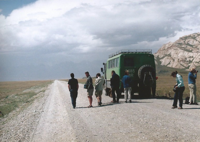
On the road to Tash Rabat arriving from the Torugart mountain pass
See: Torugart pass
11. Lake Karakul 3600 m. (China)
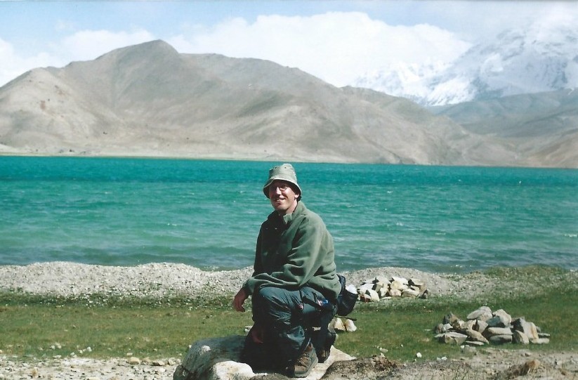
The Wandelgek at Lake Karakul…
OK, this is simply the most beautiful place on earth that I have visited (2nd would be the Lalung La Pass in Tibet and 3rd Mount Everest and environment). On his journey on the Silk Road, the Wandelgek visited this high altitude mountain lake in 2004. You can get there via transport which can be arranged at John’s Information and Cafe in Kashgar, but fortunately the rented van showed some technical failures while on the road and it needed a thorough mending, causing a great deal of the trip to become much more exciting. A truck on the way to Kashgar was hailed and after some consultation and negotiation on a fee, the Wandelgek was suddenly driving in the back of the truck with a 360 degree view over the surrounding snow capped Pamir giants. At the Karakul Lake, The Wandelgek stayed for the night in a Kyrgyz yurt and there was also time galore for a considerable walk on the lakes borders, which included seeing a hunt for escaped camels which was quite a spectacle.
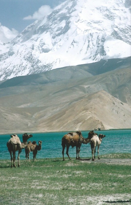
Escaped bactrian camels…
The Karakul or Karakuli (“black lake”) is a lake located 196 km from Kashgar, Xinjiang province, China, in Akto County, Kizilsu Kirgiz Autonomous Prefecture on the Karakoram Highway, just before reaching Tashkurgan and the Khunjerab Pass on the border between china and Sost in Pakistan. At an altitude of 3600 m it is the highest lake of the Pamir plateau, near the divide of the Pamir, Tian Shan and Kunlun mountain ranges. It is surrounded by mountains covered with snow throughout the year. The three highest peaks visible from the lake are the Muztagh Ata (7546 m), Kongur Tagh (7649 m) and Kongur Tiube (7530 m). The lake is popular among travelers for its beautiful scenery and the clarity of the reflection in the water. The color of the water ranges from dark green to azure and light blue. There are two Kirgiz settlements along the shore of Karakul lake: a small number of yurts about 1km east of the bus drop-off point and a village with stone houses located on the western shore.
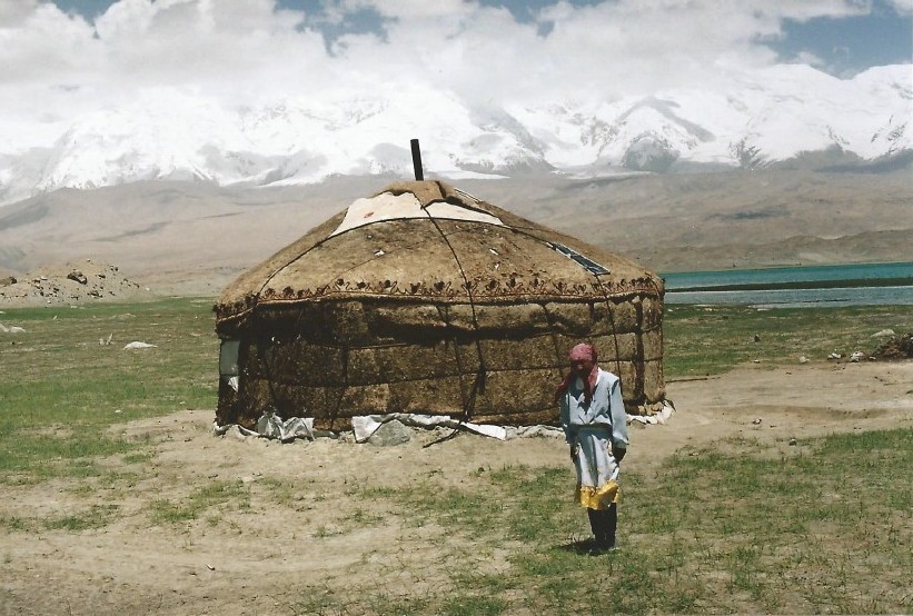
Sleeping in a Kyrgyz yurt…
See: Walking on the borders of Lake Karakul
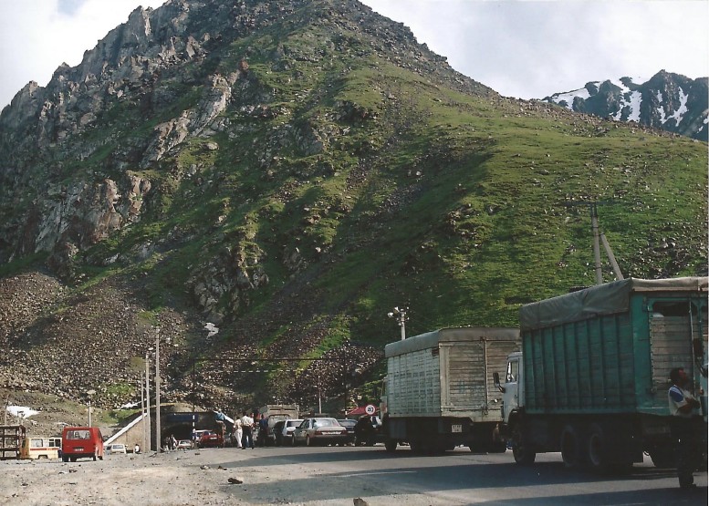
12. Tuu Ashuu 3586 m. (Kyrgyzstan)
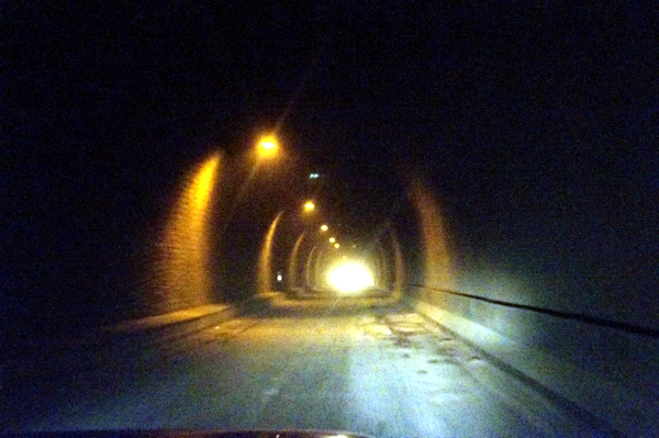
The Tuu Ashu tunnel…
Töö Ashuu (Kyrgyz: Төө-Ашуу, [toe ɑʃu ː ː]; Russian: Тёо Ашуу), literally “camels pass”, is a mountain pass in Kyrgyzstan on the highway from Bishkek to Osh at about 120 km. from Bishkek. The pass is located in the Kyrgyz Alatau which are part of the Tien Shan mountains. There is a tunnel built at an altitude of 3130m to 3180m above sea level. The Wandelgek journeyed from Bishkek over this pass to the Suusamyr valley which lies behind the tunnel. There was still work in progress on the Tunnel, making sure that there were traffic jams at the entrance and the air conditioning within the tunnel was not operational yet (2004). With a handkerchief covering the mouth and nose area, the Wandelgek drove through the this stinking tunnel. On the other side of the pass you will find a magnificent view of the Suusamyr valley.
Traffic jam at the tunnel entrance…
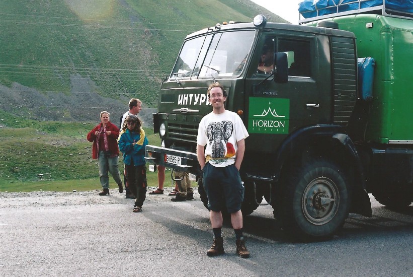
The Wandelgek on the Tuu Ashu mountain pass just before entering the tunnel…
See: Tuu Ashuu
View from the Tuu Ashuu pass over the Suusamyr valley…
13. Moldo Ashuu 3201 m. (Kyrgyzstan)
Light snowfall on the road to the Moldo Ashuu mountain pass, that leads to Song Kol…
In the valley of the Tuu Ashuu pass the Wandelgek spent the night in a tent. It was at that location more sheltered against a harsh and cold wind than at the Song Kol lake, and the weather didn’t promise to be good. The next day the Wandelgek drove over the Moldo Ashuu pass. The Moldo Ashuu pass between Ak-Tal and Song Kol lake is a high and windy pass and when crossing it even there was even some light snowfall.
See: Song Kul
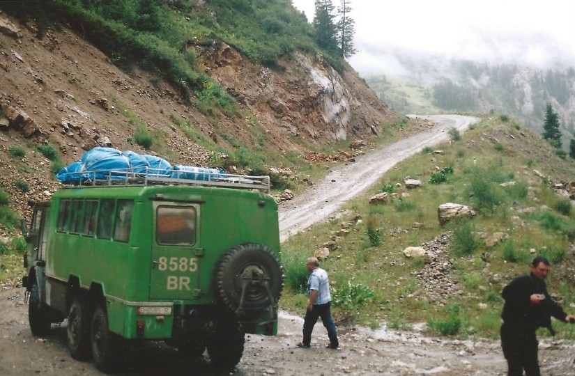
14. Ala Bel 3175 m. (Kyrgyzstan)
The road to the Ala Bel Pass runs through a narrow gorge at the western end of the Suusamyr valley before reaching the pass. A white water river runs through the gorge. The pass is lower than the Tuu Ashuu pass.
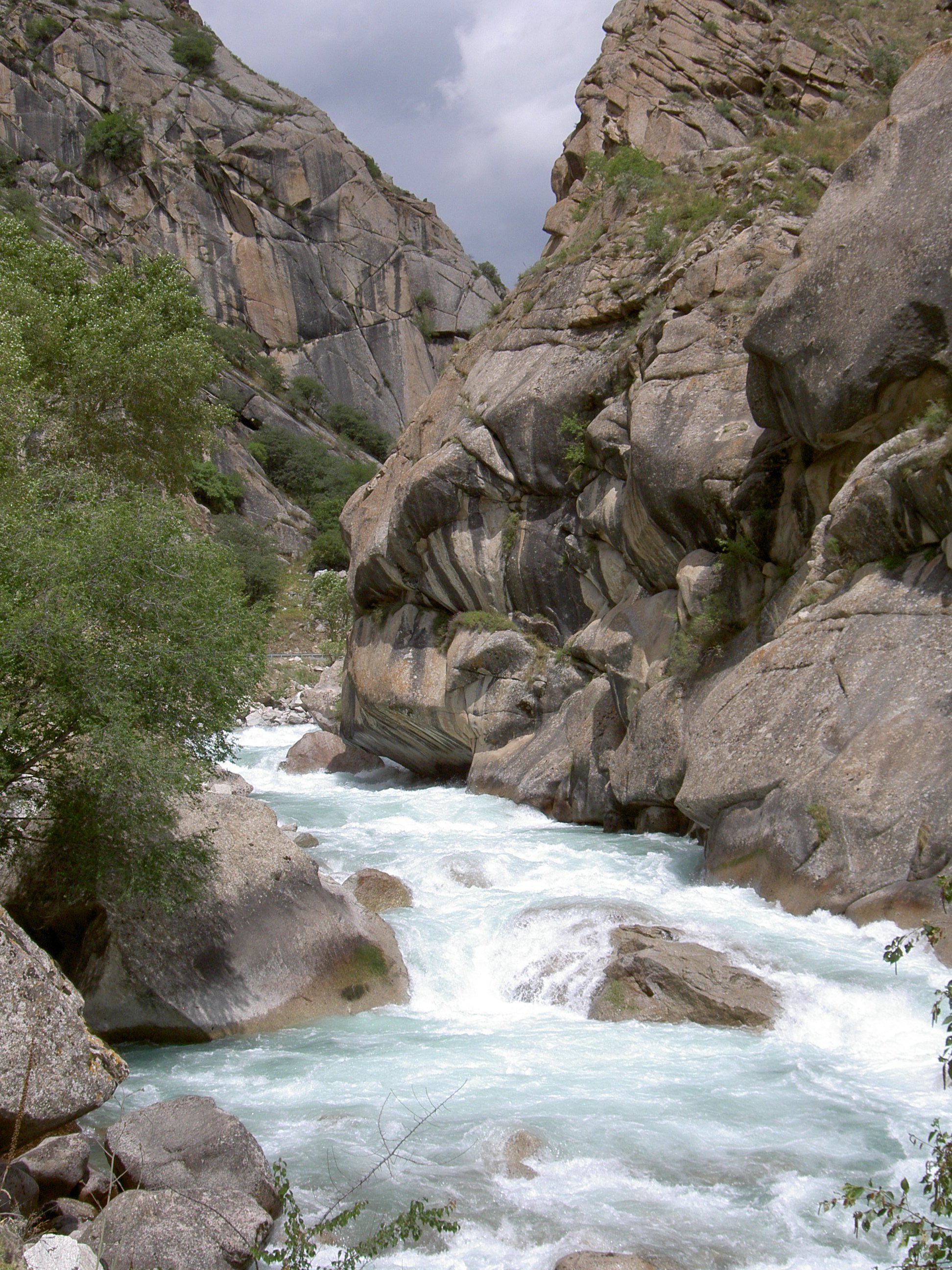
White water in the ravine…
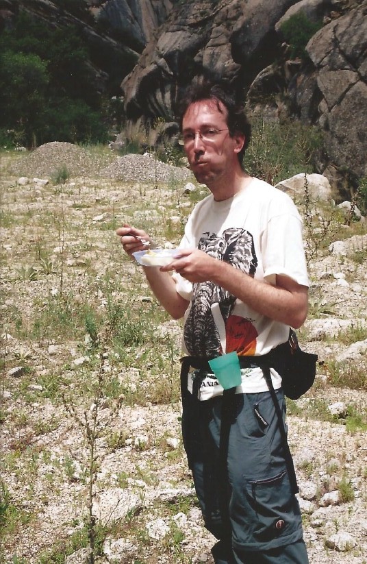
The Wandelgek near the Ala Bel mountain pass…
The road and the river cut through steep rock formations. Eventually the gorge opens into the valley of the Toktogul reservoir.
During the climb there was time for a lunch break.
See: Ala Bel
Italy: Dolomites
15. Alpe di Siusi 1680 m. – 2350 m. (High Plain in the Dolomites)
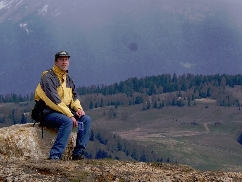
The Wandelgek on the Alpe di Siusi…
In 2010 The Wandelgek was spotted for the 2nd time in Italy, this time while hiking through the Dolomites. He walked over the Seiser Alm, the largest high mountain plain in Europe. He did this in the late Spring, but despite that there was still an abundance of snow on the plain, because of the relative cool spring of 2010. The plain consists of a green mountain meadow which is 57 square kilometers wide.
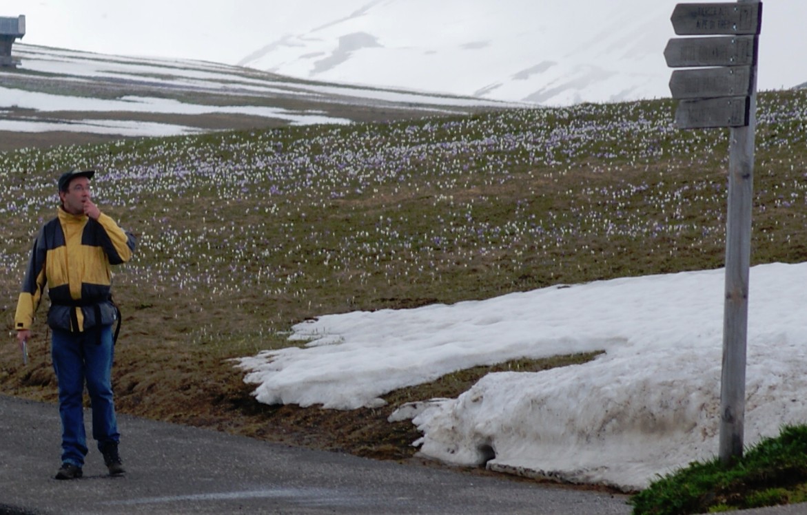
An abundance of signposts in this hiking paradise…
On the Seiser Alm it’s forbidden to drive a motorized vehicle which means there’s no motorized traffic and it is a hiker‘s paradise. The area is large enough to walk for several days, especially if you are climbing the mountain Schlern (but you should really wait until the snow has melted).
See: Walking on the Alpe di Siusi 1 and Walking on the Alpe di Siusi 2
Indonesia: Java
16. Puncak pass 1500 m. (Indonesia)
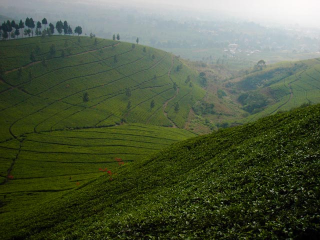
View over the tea plantations from the Puncak mountain pass…
In 2002 the Wandelgek traveled over the Indonesian island of Java. The travel route ran from Jakarta to Bogor and thence across the Puncak Pass with its high tea plantations to Bandung.
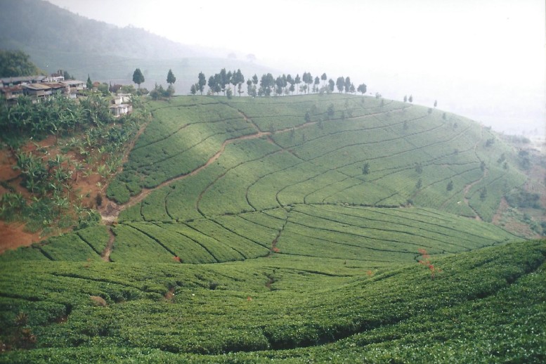
Tea, tea again and even more tea…
See: Puncak pass
Sweden
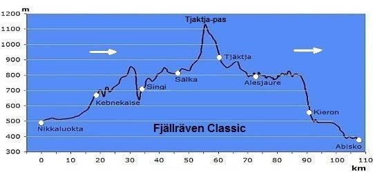
In 1993, the Wandelgek walked through the Scandinavian highlands from Abisko to Nikkaluokta over the Kungsleden (King’s trail). This process is also known as the Fjallraven Classic although in reversed direction.
17. Tjaktja pas 1151 m. (Lapland)
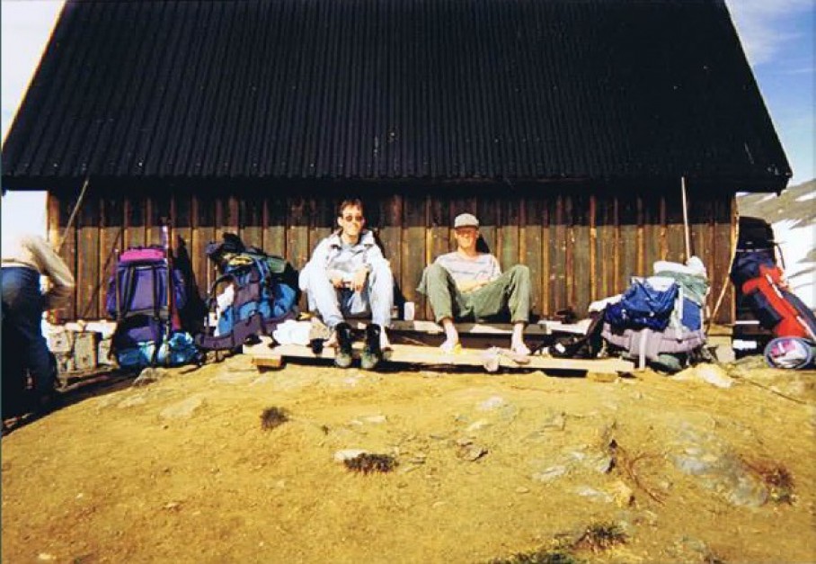
The Wandelgek at the Tjaktja pass shelter cabin…
The Tjaktja Pass is the highest mountain pass (the highest point) of the entire Kungsleden. When the Wandelgek walked over the pass, there was lots of snow and ice. The stage from the Tjaktja cabins to Salka cabins is only 12 km., but the snow (quite deep snow too) is quite difficult to walk. On top of the pass is a weather shelter cabin and the view is fantastic.
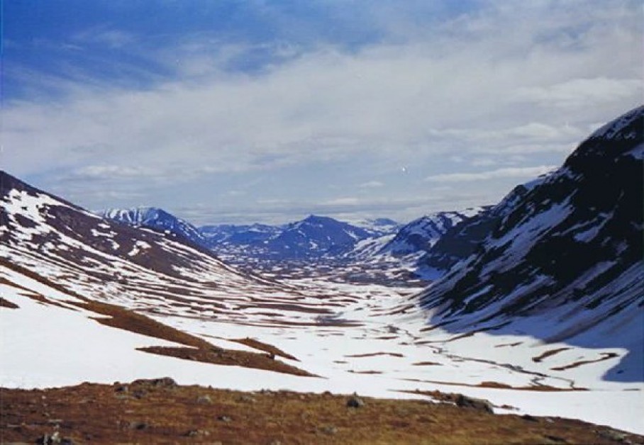
View from the Tjaktja mountain pass over the valley of the Salka huts…
See: Kungsleden Day 4
18. Kieron pass 550 m. (Lapland)
On the Kieron mountain pass…
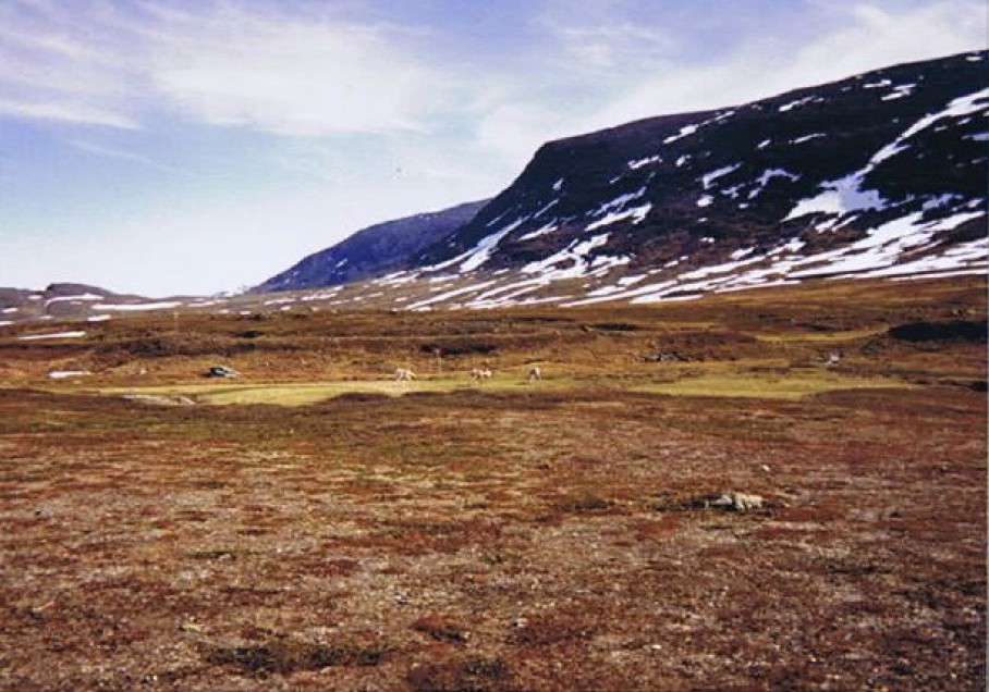
During the second day of the trek over the Kungsleden, a great difference in height is overcome by crossing the Kieron mountain pass to the Alesjaure valley. The pass is cold, windy and open. A lot of reindeer use the pass to cross the mountains, and there is some snow and ice in the summer. After the pass the descent is minimal and the starts to continually rise. The view over the valley of Alesjaure is magnificent.
See: Kungsleden Day 2
The valley of the Alesjaure lake after crossing the Kieron pass…